Approximate Location Map
Large Map »
Latitude: 51.4851 / 51°29'6"N
Longitude: -1.0346 / 1°2'4"W
OS Eastings: 467129
OS Northings: 176678
OS Grid: SU671766
Mapcode National: GBR Q43.R2
Mapcode Global: VHDWL.0XWX
Plus Code: 9C3WFXP8+25
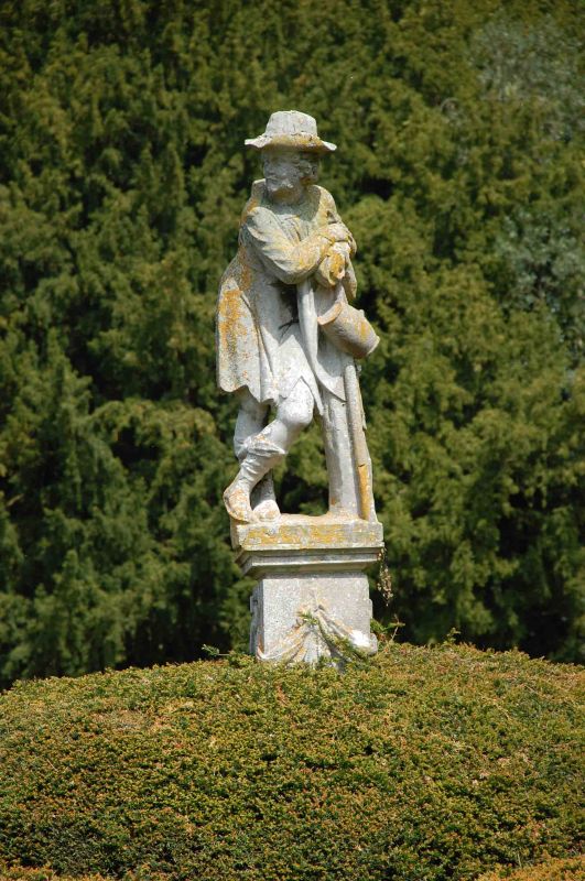
Entry Name: Statue Approximately 70 Metres North East of Mapledurham House
Listing Date: 16 August 1985
Grade: II
Source: Historic England
Source ID: 1180520
English Heritage Legacy ID: 247410
ID on this website: 101180520
Location: Mapledurham, South Oxfordshire, RG4
County: Oxfordshire
District: South Oxfordshire
Civil Parish: Mapledurham
Traditional County: Oxfordshire
Lieutenancy Area (Ceremonial County): Oxfordshire
Church of England Parish: Caversham Thameside and Mapledurham
Church of England Diocese: Oxford
Tagged with: Statue
MAPLEDURHAM THE STREET
SU67NE (East side)
9/192 Statue approx. 70m. NE of
Mapledurham House
GV II
Statue. C18. Brick base; stone top and statue. Carved swags to top of base.
Figure of countryman.
Listing NGR: SU6712976678
External links are from the relevant listing authority and, where applicable, Wikidata. Wikidata IDs may be related buildings as well as this specific building. If you want to add or update a link, you will need to do so by editing the Wikidata entry.


Other nearby listed buildings
