Approximate Location Map
Large Map »
Latitude: 51.6464 / 51°38'47"N
Longitude: -1.0025 / 1°0'9"W
OS Eastings: 469112
OS Northings: 194652
OS Grid: SU691946
Mapcode National: GBR B1Y.RBP
Mapcode Global: VHDVT.KWV7
Plus Code: 9C3WJXWW+HX
Entry Name: Walls Enclosing Garden to North of Number 46 (East End House)
Listing Date: 11 December 1985
Grade: II
Source: Historic England
Source ID: 1059381
English Heritage Legacy ID: 247678
ID on this website: 101059381
Location: Watlington, South Oxfordshire, OX49
County: Oxfordshire
District: South Oxfordshire
Civil Parish: Watlington
Built-Up Area: Watlington
Traditional County: Oxfordshire
Lieutenancy Area (Ceremonial County): Oxfordshire
Church of England Parish: Watlington
Church of England Diocese: Oxford
Tagged with: Wall
SU6994
7/205
WATLINGTON
SHIRBURN STREET
(East side)
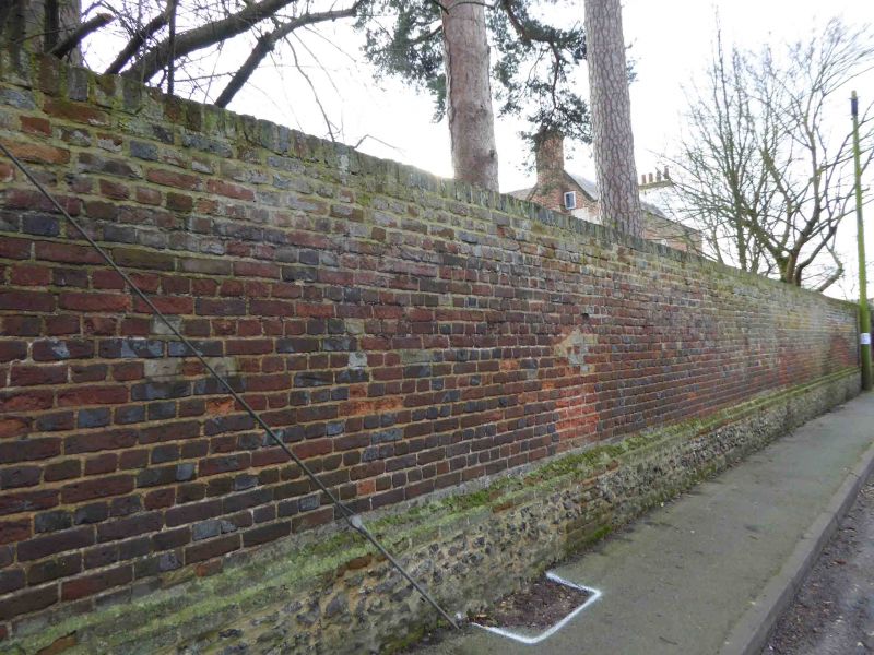
Walls enclosing garden to N of No.46 (East End House)
GV
II
Walls. Early C18. English bond brick on flint rubble base. Included for group
value.
Listing NGR: SU6911294652
External links are from the relevant listing authority and, where applicable, Wikidata. Wikidata IDs may be related buildings as well as this specific building. If you want to add or update a link, you will need to do so by editing the Wikidata entry.


Other nearby listed buildings
