Approximate Location Map
Large Map »
Latitude: 51.622 / 51°37'19"N
Longitude: -1.1037 / 1°6'13"W
OS Eastings: 462144
OS Northings: 191844
OS Grid: SU621918
Mapcode National: GBR B26.9RD
Mapcode Global: VHCYH.THCF
Plus Code: 9C3WJVCW+QG
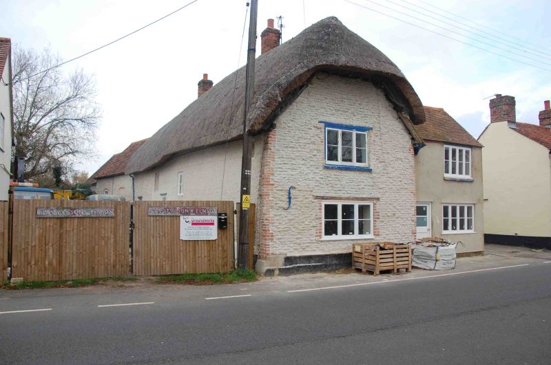
Entry Name: 29, Brook Street
Listing Date: 28 November 1985
Grade: II
Source: Historic England
Source ID: 1059391
English Heritage Legacy ID: 247717
ID on this website: 101059391
Location: Benson, South Oxfordshire, OX10
County: Oxfordshire
District: South Oxfordshire
Civil Parish: Benson
Built-Up Area: Benson
Traditional County: Oxfordshire
Lieutenancy Area (Ceremonial County): Oxfordshire
Church of England Parish: Benson
Church of England Diocese: Oxford
Tagged with: Building
SU69SW
2/9
BENSON
BROOK STREET
(North side)
No.29
GV
II
House. C17 with C19 alterations. Painted stone rubble; thatch half-hipped roof;
brick stacks. 2-storey, 3-window range at right-angles to street. Irregular
fenestration of casements including C17 window. Plank door to right-hand return
to street. Interior not inspected.
Listing NGR: SU6214491844
External links are from the relevant listing authority and, where applicable, Wikidata. Wikidata IDs may be related buildings as well as this specific building. If you want to add or update a link, you will need to do so by editing the Wikidata entry.


Other nearby listed buildings
