Approximate Location Map
Large Map »
Latitude: 51.6347 / 51°38'4"N
Longitude: -1.0993 / 1°5'57"W
OS Eastings: 462430
OS Northings: 193258
OS Grid: SU624932
Mapcode National: GBR B20.JVR
Mapcode Global: VHCYH.W5PP
Plus Code: 9C3WJWM2+V7
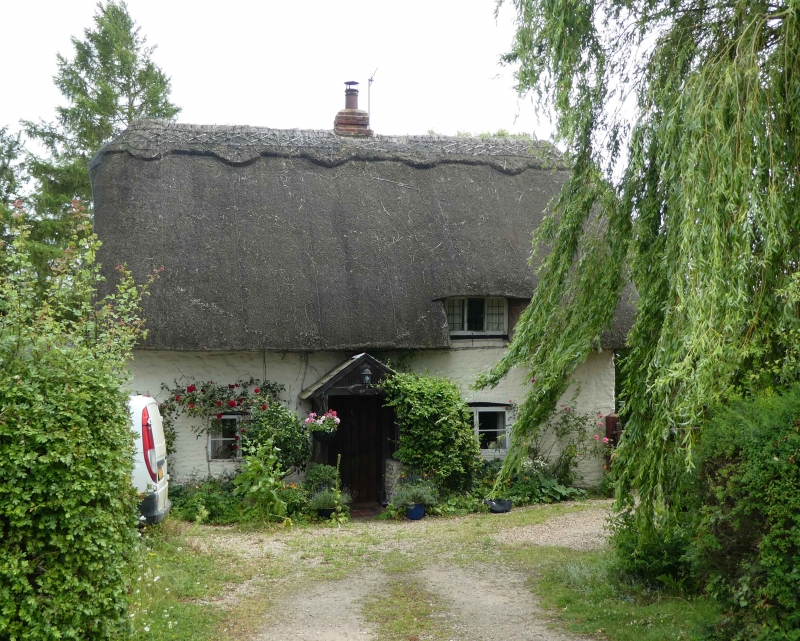
Entry Name: Woodbine Cottage
Listing Date: 28 November 1985
Grade: II
Source: Historic England
Source ID: 1369059
English Heritage Legacy ID: 247789
ID on this website: 101369059
Location: Roke, South Oxfordshire, OX10
County: Oxfordshire
District: South Oxfordshire
Civil Parish: Berrick Salome
Traditional County: Oxfordshire
Lieutenancy Area (Ceremonial County): Oxfordshire
Church of England Parish: Benson
Church of England Diocese: Oxford
Tagged with: Cottage Thatched cottage
BENSON ROKE
SU69SW
2/80 Woodbine Cottage
II
Cottage. C18. Painted limestone rubble; thatch roof; brick ridge stack to
centre. Lobby-entry plan. Single-storey and attic; 2-window range. Central plank
door. 2-light casement to left and right. Swept dormer to right. Interior not
inspected.
Listing NGR: SU6243093258
External links are from the relevant listing authority and, where applicable, Wikidata. Wikidata IDs may be related buildings as well as this specific building. If you want to add or update a link, you will need to do so by editing the Wikidata entry.


Other nearby listed buildings
