Approximate Location Map
Large Map »
Latitude: 51.6175 / 51°37'2"N
Longitude: -1.0675 / 1°4'3"W
OS Eastings: 464657
OS Northings: 191370
OS Grid: SU646913
Mapcode National: GBR B28.DYD
Mapcode Global: VHCYJ.GL0X
Plus Code: 9C3WJW8J+XX
Entry Name: Wall Adjoining God's Place to East
Listing Date: 28 November 1985
Grade: II
Source: Historic England
Source ID: 1194467
English Heritage Legacy ID: 247808
ID on this website: 101194467
Location: Ewelme, South Oxfordshire, OX10
County: Oxfordshire
District: South Oxfordshire
Civil Parish: Ewelme
Built-Up Area: Benson
Traditional County: Oxfordshire
Lieutenancy Area (Ceremonial County): Oxfordshire
Church of England Parish: Ewelme
Church of England Diocese: Oxford
Tagged with: Wall
SU6491
8/99
EWELME
HIGH STREET
(North side)
Wall adjoining God's Place to E
GV
II
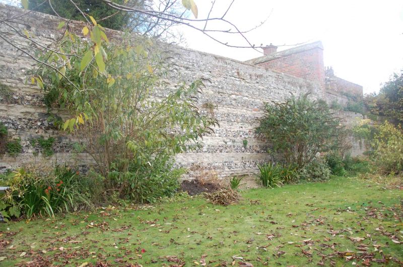
Wall. C15. Banded knapped flint and limestone rubble; round red brick coping.
Probably built as part of the complex of buildings erected by the Earl and
Countess of Suffolk. Divides the almshouse gardens and the churchyard.
Listing NGR: SU6465791370
External links are from the relevant listing authority and, where applicable, Wikidata. Wikidata IDs may be related buildings as well as this specific building. If you want to add or update a link, you will need to do so by editing the Wikidata entry.


Other nearby listed buildings
