Approximate Location Map
Large Map »
Latitude: 51.591 / 51°35'27"N
Longitude: -1.2409 / 1°14'27"W
OS Eastings: 452680
OS Northings: 188291
OS Grid: SU526882
Mapcode National: GBR 912.C27
Mapcode Global: VHCYM.F8TN
Plus Code: 9C3WHQR5+CJ
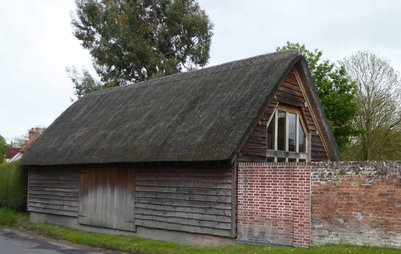
Entry Name: Barn Approximately 10 Metres North East of Number 19
Listing Date: 4 November 1986
Grade: II
Source: Historic England
Source ID: 1285224
English Heritage Legacy ID: 248664
ID on this website: 101285224
Location: East Hagbourne, South Oxfordshire, OX11
County: Oxfordshire
District: South Oxfordshire
Civil Parish: East Hagbourne
Built-Up Area: Didcot
Traditional County: Berkshire
Lieutenancy Area (Ceremonial County): Oxfordshire
Church of England Parish: Hagbourne
Church of England Diocese: Oxford
Tagged with: Barn Thatched barn
EAST HAGBOURNE MAIN ROAD
SU5288 (South side)
14/51 Barn approx. 1Om. NE of No.19
GV II
Barn. C18. Timber-framing; weatherboarding; thatch roof. 3-bay barn. Central double plank doors. Interior not inspected. Included for group value.
Listing NGR: SU5268088291
External links are from the relevant listing authority and, where applicable, Wikidata. Wikidata IDs may be related buildings as well as this specific building. If you want to add or update a link, you will need to do so by editing the Wikidata entry.


Other nearby listed buildings
