Approximate Location Map
Large Map »
Latitude: 51.5913 / 51°35'28"N
Longitude: -1.2574 / 1°15'26"W
OS Eastings: 451537
OS Northings: 188313
OS Grid: SU515883
Mapcode National: GBR 912.0YJ
Mapcode Global: VHCYM.583F
Plus Code: 9C3WHPRV+G2
Entry Name: Cross
Listing Date: 4 November 1986
Grade: II
Source: Historic England
Source ID: 1368794
English Heritage Legacy ID: 248669
ID on this website: 101368794
Location: Coscote, South Oxfordshire, OX11
County: Oxfordshire
District: South Oxfordshire
Civil Parish: East Hagbourne
Traditional County: Berkshire
Lieutenancy Area (Ceremonial County): Oxfordshire
Church of England Parish: Hagbourne
Church of England Diocese: Oxford
EAST HAGBOURNE PARK ROAD
SU58NW (West side)
Coscote
6/56 Cross
- II
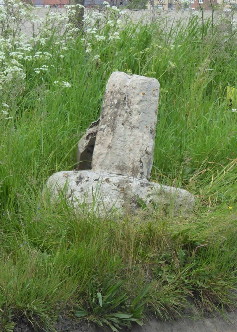
Village Cross. C15. Stone. Rough-hewn circular base. Remains of octagonal
tapering shaft.
Listing NGR: SU5153788313
External links are from the relevant listing authority and, where applicable, Wikidata. Wikidata IDs may be related buildings as well as this specific building. If you want to add or update a link, you will need to do so by editing the Wikidata entry.


Other nearby listed buildings
