Approximate Location Map
Large Map »
Latitude: 51.5861 / 51°35'9"N
Longitude: -1.2605 / 1°15'37"W
OS Eastings: 451329
OS Northings: 187730
OS Grid: SU513877
Mapcode National: GBR 912.D52
Mapcode Global: VHCYM.3DGF
Plus Code: 9C3WHPPQ+CQ
Entry Name: Cob Wall Attached to South of Wycherts
Listing Date: 4 November 1986
Grade: II
Source: Historic England
Source ID: 1285017
English Heritage Legacy ID: 248767
ID on this website: 101285017
Location: West Hagbourne, South Oxfordshire, OX11
County: Oxfordshire
District: South Oxfordshire
Town: South Oxfordshire
Civil Parish: West Hagbourne
Traditional County: Berkshire
Lieutenancy Area (Ceremonial County): Oxfordshire
Church of England Parish: Hagbourne
Church of England Diocese: Oxford
Tagged with: Wall
SU5187
18/154
WEST HAGBOURNE
MAIN STREET
(East side)
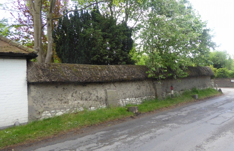
Cob wall attached to S of Wycherts
GV
II
Wall. C18. Cob with thatch coping.
Listing NGR: SU5132987730
External links are from the relevant listing authority and, where applicable, Wikidata. Wikidata IDs may be related buildings as well as this specific building. If you want to add or update a link, you will need to do so by editing the Wikidata entry.


Other nearby listed buildings
