Approximate Location Map
Large Map »
Latitude: 51.6506 / 51°39'2"N
Longitude: -1.2661 / 1°15'58"W
OS Eastings: 450869
OS Northings: 194896
OS Grid: SU508948
Mapcode National: GBR 7YY.JP9
Mapcode Global: VHCY7.0SH1
Plus Code: 9C3WMP2M+6G
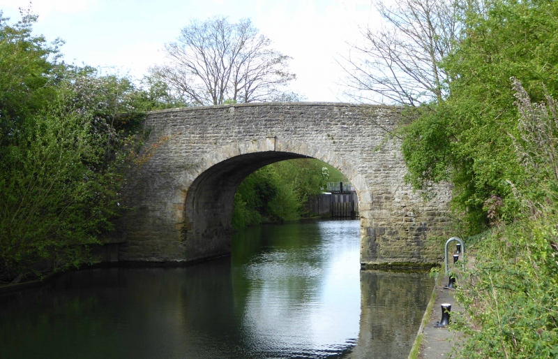
Entry Name: Bridge over Culham Cut
Listing Date: 18 July 1963
Grade: II
Source: Historic England
Source ID: 1368839
English Heritage Legacy ID: 248826
ID on this website: 101368839
Location: Culham, South Oxfordshire, OX14
County: Oxfordshire
District: South Oxfordshire
Civil Parish: Culham
Built-Up Area: Culham
Traditional County: Oxfordshire
Lieutenancy Area (Ceremonial County): Oxfordshire
Church of England Parish: Culham
Church of England Diocese: Oxford
Tagged with: Bridge
CULHAM TOLLGATE ROAD
SU5094
12/41 Bridge over Culham Cut
18/07/63
GV II
Bridge. c.1809. Coursed stone rubble with ashlar stone dressings to arch and to
end piers. Oval arch with keystone. Plain parapet.
(V.C.H.: Oxfordshire, Vol.7, p.28, 1962).
Listing NGR: SU5086994896
External links are from the relevant listing authority and, where applicable, Wikidata. Wikidata IDs may be related buildings as well as this specific building. If you want to add or update a link, you will need to do so by editing the Wikidata entry.


Other nearby listed buildings
