Approximate Location Map
Large Map »
Latitude: 51.6696 / 51°40'10"N
Longitude: -1.0845 / 1°5'4"W
OS Eastings: 463410
OS Northings: 197160
OS Grid: SU634971
Mapcode National: GBR B1N.8N6
Mapcode Global: VHCYB.591D
Plus Code: 9C3WMW98+V6
Entry Name: 59 and 61, High Street
Listing Date: 3 April 1987
Grade: II
Source: Historic England
Source ID: 1284817
English Heritage Legacy ID: 248895
ID on this website: 101284817
Location: Chalgrove, South Oxfordshire, OX44
County: Oxfordshire
District: South Oxfordshire
Civil Parish: Chalgrove
Built-Up Area: Chalgrove
Traditional County: Oxfordshire
Lieutenancy Area (Ceremonial County): Oxfordshire
Church of England Parish: Chalgrove
Church of England Diocese: Oxford
Tagged with: Building Thatched cottage
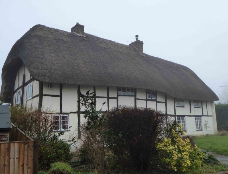
CHALGROVE HIGH STREET
SU6397 (North side)
9/49 Nos.59 and 61
- II
House. C17. Small timber framing; half-hipped thatch roof; brick ridge stacks.
4-unit plan. 2 storeys; 4-window range. C20 door and casements. Interior not
inspected but likely to be of interest.
Listing NGR: SU6341097160
External links are from the relevant listing authority and, where applicable, Wikidata. Wikidata IDs may be related buildings as well as this specific building. If you want to add or update a link, you will need to do so by editing the Wikidata entry.


Other nearby listed buildings
