Approximate Location Map
Large Map »
Latitude: 51.5969 / 51°35'48"N
Longitude: -1.1253 / 1°7'30"W
OS Eastings: 460686
OS Northings: 189036
OS Grid: SU606890
Mapcode National: GBR 911.Y1L
Mapcode Global: VHCYP.F4Z4
Plus Code: 9C3WHVWF+QV
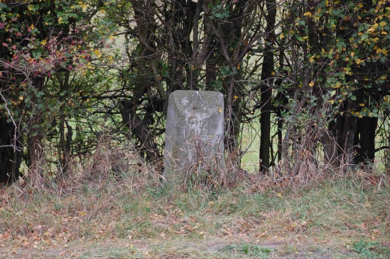
Entry Name: Milestone Approximately 1 Metre South of Angier's Almshouses
Listing Date: 9 February 1988
Grade: II
Source: Historic England
Source ID: 1048502
English Heritage Legacy ID: 249284
ID on this website: 101048502
Location: Wallingford, South Oxfordshire, OX10
County: Oxfordshire
District: South Oxfordshire
Civil Parish: Wallingford
Built-Up Area: Wallingford
Traditional County: Berkshire
Lieutenancy Area (Ceremonial County): Oxfordshire
Tagged with: Milestone
SU6089SE
11/183
WALLINGFORD
READING ROAD
Milestone approx. 1m S of Angier's Almshouses
GV
II
Milestone. C18, resited in original position c.1986, Stone. Half-circular with
angled top. Inscribed Oxford I3, Reading 15".
Listing NGR: SU6068689036
External links are from the relevant listing authority and, where applicable, Wikidata. Wikidata IDs may be related buildings as well as this specific building. If you want to add or update a link, you will need to do so by editing the Wikidata entry.


Other nearby listed buildings
