Approximate Location Map
Large Map »
Latitude: 51.6006 / 51°36'2"N
Longitude: -1.1215 / 1°7'17"W
OS Eastings: 460945
OS Northings: 189449
OS Grid: SU609894
Mapcode National: GBR 911.R8W
Mapcode Global: VHCYP.H1Z9
Plus Code: 9C3WJV2H+6C
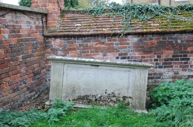
Entry Name: Chest Tomb Approximately 1 Metre South East of Church of St Peter
Listing Date: 9 February 1988
Grade: II
Source: Historic England
Source ID: 1368505
English Heritage Legacy ID: 249327
ID on this website: 101368505
Location: St Peter's Church, Wallingford, South Oxfordshire, OX10
County: Oxfordshire
District: South Oxfordshire
Civil Parish: Wallingford
Built-Up Area: Wallingford
Traditional County: Berkshire
Lieutenancy Area (Ceremonial County): Oxfordshire
Tagged with: Chest tomb
SU6089SE
11/160
WALLINGFORD
THAMES STREET
(East side)
Wallingford
Chest tomb approx, 1m. SE of Church of St. Peter
GV
II
Chest tomb. Probably early C19. Rectangular. Fielded panel to each side with
cabled fluting to ends. Shaped moulding to edge of flat top.
Listing NGR: SU6094589449
External links are from the relevant listing authority and, where applicable, Wikidata. Wikidata IDs may be related buildings as well as this specific building. If you want to add or update a link, you will need to do so by editing the Wikidata entry.


Other nearby listed buildings
