Approximate Location Map
Large Map »
Latitude: 51.6006 / 51°36'2"N
Longitude: -1.122 / 1°7'19"W
OS Eastings: 460904
OS Northings: 189446
OS Grid: SU609894
Mapcode National: GBR 911.R3D
Mapcode Global: VHCYP.H1PB
Plus Code: 9C3WJV2H+65
Entry Name: The Cottage and Attached Churchyard Wall and Wall to High Street
Listing Date: 9 February 1988
Grade: II
Source: Historic England
Source ID: 1368506
English Heritage Legacy ID: 249331
ID on this website: 101368506
Location: Wallingford, South Oxfordshire, OX10
County: Oxfordshire
District: South Oxfordshire
Civil Parish: Wallingford
Built-Up Area: Wallingford
Traditional County: Berkshire
Lieutenancy Area (Ceremonial County): Oxfordshire
Tagged with: Cottage
11/164
WALLINGFORD,
THAMES STREET (east side),
No.1 (The Cottage) and attached churchyard walls and wall to High Street
GV
II
Lodge, now house. Late C18, with C19 alterations. Red brick with flared headers
in Flemish bond; slate hipped roof; C19 brick lateral stack to rear. Two-storey,
5-window range fronting to Bridge House (q.v.) forecourt. C20 door with fanlight
and painted reeded wood surround to centre. 12-pane sashes with segmental brick
heads to left. Fenestration to ground floor right enclosed by C20 addition. Flat
brick band between ground and first floors. Five 6-pane unhorned sashes with
segmental brick heads to first floor. Plain parapet to eaves. C19 fenestration
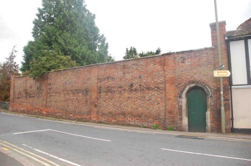
to rear, facing road. Interior not inspected. Attached walls enclosing
churchyard with outer faces of red brick and flared headers in Flemish bond
approx. 3m. high and forming rectangle approx. 50m. by 30m. Inner face of wall
has areas of stone and flint, probably reusing earlier stonework. Wrought iron
gate and overthrow to Thames Street.
Wall to High Street between No.1 High
Street (not included) and Wallingford Bridge. Red brick with flared headers in
Flemish bond approx. 2.5m. high and 30m. long. Included for group value.
Listing NGR: SU6090489446
External links are from the relevant listing authority and, where applicable, Wikidata. Wikidata IDs may be related buildings as well as this specific building. If you want to add or update a link, you will need to do so by editing the Wikidata entry.


Other nearby listed buildings
