Approximate Location Map
Large Map »
Latitude: 51.658 / 51°39'28"N
Longitude: -1.5859 / 1°35'9"W
OS Eastings: 428742
OS Northings: 195553
OS Grid: SU287955
Mapcode National: GBR 5VP.V6F
Mapcode Global: VHC0L.GLG9
Plus Code: 9C3WMC57+6J
Entry Name: 7, Gloucester Street
Listing Date: 10 July 1986
Grade: II
Source: Historic England
Source ID: 1283425
English Heritage Legacy ID: 249384
ID on this website: 101283425
Location: Faringdon, Vale of White Horse, Oxfordshire, SN7
County: Oxfordshire
District: Vale of White Horse
Civil Parish: Great Faringdon
Built-Up Area: Faringdon
Traditional County: Berkshire
Lieutenancy Area (Ceremonial County): Oxfordshire
Church of England Parish: Faringdon
Church of England Diocese: Oxford
Tagged with: Building
GREAT FARINGDON GLOUCESTER STREET
SU 2895 (south side)
3/36 No 7
-
GV II
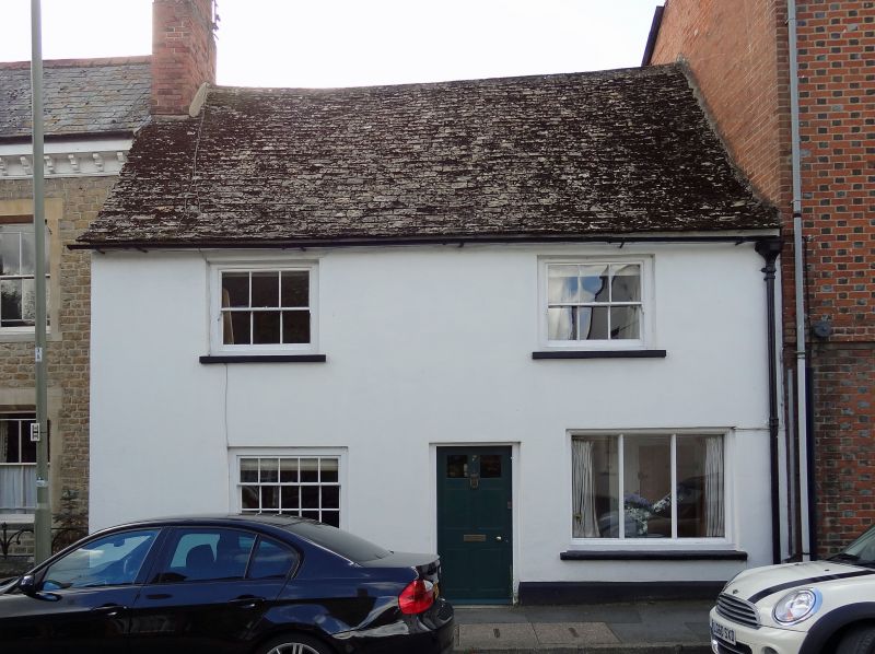
C19 stucco refronting of C17 or early C18 house. 2-storey, stone tiled roof.
2-window range, early C19 sash windows to 1st floor. One glazing bar sash and
3-light shop window to ground floor. Chamfered and stopped centre beam to
ground floor.
Listing NGR: SU2874295553
External links are from the relevant listing authority and, where applicable, Wikidata. Wikidata IDs may be related buildings as well as this specific building. If you want to add or update a link, you will need to do so by editing the Wikidata entry.


Other nearby listed buildings
