Approximate Location Map
Large Map »
Latitude: 51.6283 / 51°37'41"N
Longitude: -1.3 / 1°17'59"W
OS Eastings: 448550
OS Northings: 192393
OS Grid: SU485923
Mapcode National: GBR 7Z3.VJ0
Mapcode Global: VHCYD.FB3M
Plus Code: 9C3WJPH2+82
Entry Name: Font, Approximately 25 Metres South East of Church of St Blaise
Listing Date: 5 May 1988
Grade: II
Source: Historic England
Source ID: 1200074
English Heritage Legacy ID: 250019
Also known as: font
ID on this website: 101200074
Location: St Blaise's Church, Milton, Vale of White Horse, Oxfordshire, OX14
County: Oxfordshire
District: Vale of White Horse
Civil Parish: Milton
Built-Up Area: Didcot
Traditional County: Berkshire
Lieutenancy Area (Ceremonial County): Oxfordshire
Church of England Parish: Milton
Church of England Diocese: Oxford
Tagged with: Baptismal font
MILTON HIGH STREET
SU4892 (West side)
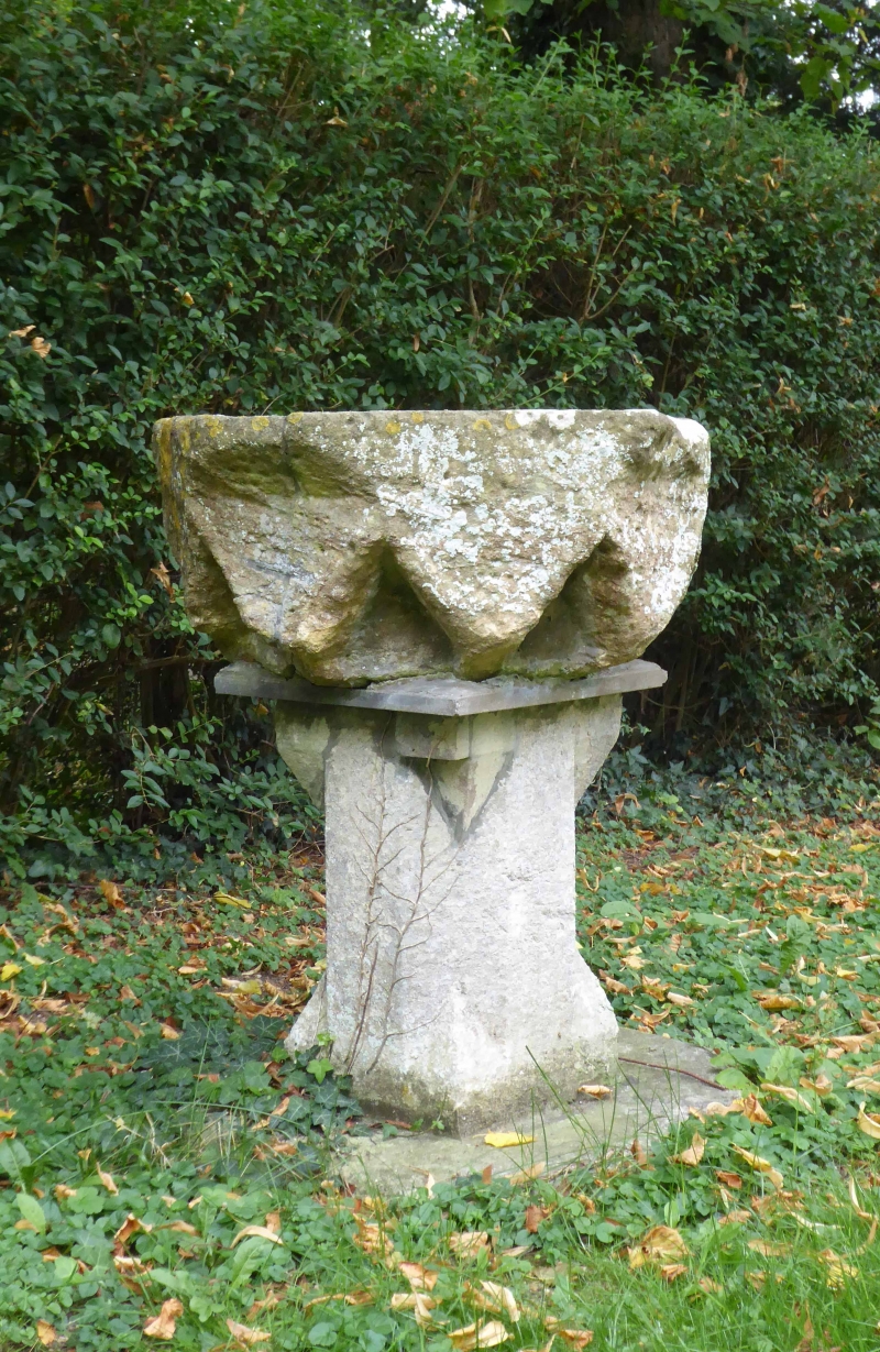
8/156 Font, approx. 25m SE of Church
of St. Blaise
GV II
Font. C14 stone bowl of C19 stone pillar. Octagonal pillar. Octagonal with
inverted cross-gabled base. Included for group value.
Listing NGR: SU4855092393
External links are from the relevant listing authority and, where applicable, Wikidata. Wikidata IDs may be related buildings as well as this specific building. If you want to add or update a link, you will need to do so by editing the Wikidata entry.


Other nearby listed buildings
