Approximate Location Map
Large Map »
Latitude: 51.5961 / 51°35'45"N
Longitude: -1.3398 / 1°20'23"W
OS Eastings: 445828
OS Northings: 188786
OS Grid: SU458887
Mapcode National: GBR 7ZF.XRV
Mapcode Global: VHCYK.Q4KS
Plus Code: 9C3WHMW6+C3
Entry Name: Cemetery Cross, Approximately 25 Metres South West of White Cottage
Listing Date: 9 February 1976
Grade: II
Source: Historic England
Source ID: 1199683
English Heritage Legacy ID: 250091
ID on this website: 101199683
Location: East Hendred, Vale of White Horse, Oxfordshire, OX12
County: Oxfordshire
District: Vale of White Horse
Civil Parish: East Hendred
Built-Up Area: East Hendred
Traditional County: Berkshire
Lieutenancy Area (Ceremonial County): Oxfordshire
Tagged with: Cottage
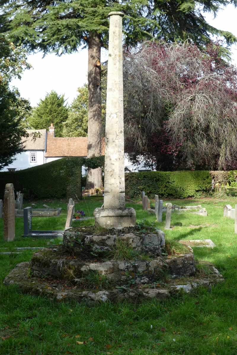
EAST HENDRED CAT STREET
SU4588 (South-west side)
19/53 Cemetery Cross, approx. 25m.
09/02/76 SW of White Cottage
GV II
Cross. Probably C15 base, with C19 shaft and cross. Stone octagonal stepped base
with tapering shaft supporting cross. Included for group value.
Listing NGR: SU4582888786
External links are from the relevant listing authority and, where applicable, Wikidata. Wikidata IDs may be related buildings as well as this specific building. If you want to add or update a link, you will need to do so by editing the Wikidata entry.


Other nearby listed buildings
