Approximate Location Map
Large Map »
Latitude: 51.6703 / 51°40'12"N
Longitude: -1.2805 / 1°16'49"W
OS Eastings: 449850
OS Northings: 197076
OS Grid: SU498970
Mapcode National: GBR 7YR.72F
Mapcode Global: VHCY6.R8DX
Plus Code: 9C3WMPC9+4Q
Entry Name: Abbey Gate
Listing Date: 19 January 1951
Grade: I
Source: Historic England
Source ID: 1368671
English Heritage Legacy ID: 250266
ID on this website: 101368671
Location: Abingdon-on-Thames, Vale of White Horse, Oxfordshire, OX14
County: Oxfordshire
District: Vale of White Horse
Civil Parish: Abingdon on Thames
Built-Up Area: Abingdon
Traditional County: Berkshire
Lieutenancy Area (Ceremonial County): Oxfordshire
Church of England Parish: Abingdon-on-Thames
Church of England Diocese: Oxford
Tagged with: Gate
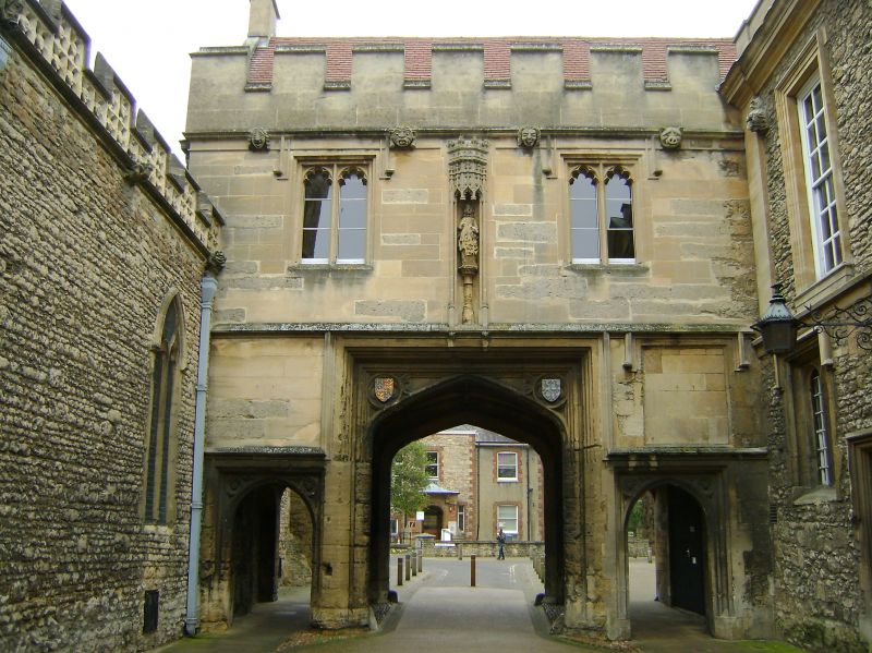
1.
752 ABBEY
SU 4997 1/148 19.1.51 Abbey Gate
I
2.
Part of Borough buildings, connecting Town Hall with St Nicholas'
Church. Late C15. Vaulting partly renewed and south pair of small
arches are nodern. Original stone newel in south west angle.
Recently, cleaned.
Listing NGR: SU4985097076
External links are from the relevant listing authority and, where applicable, Wikidata. Wikidata IDs may be related buildings as well as this specific building. If you want to add or update a link, you will need to do so by editing the Wikidata entry.


Other nearby listed buildings
