Approximate Location Map
Large Map »
Latitude: 51.6726 / 51°40'21"N
Longitude: -1.2849 / 1°17'5"W
OS Eastings: 449549
OS Northings: 197339
OS Grid: SU495973
Mapcode National: GBR 7YR.00H
Mapcode Global: VHCY6.P732
Plus Code: 9C3WMPF8+33
Entry Name: Fence and Gate to Numbers 55 and 57
Listing Date: 10 December 1971
Grade: II
Source: Historic England
Source ID: 1048921
English Heritage Legacy ID: 250289
ID on this website: 101048921
Location: Abingdon-on-Thames, Vale of White Horse, Oxfordshire, OX14
County: Oxfordshire
District: Vale of White Horse
Town: Vale of White Horse
Civil Parish: Abingdon on Thames
Built-Up Area: Abingdon
Traditional County: Berkshire
Lieutenancy Area (Ceremonial County): Oxfordshire
Church of England Parish: Abingdon-on-Thames
Church of England Diocese: Oxford
Tagged with: Building
1.
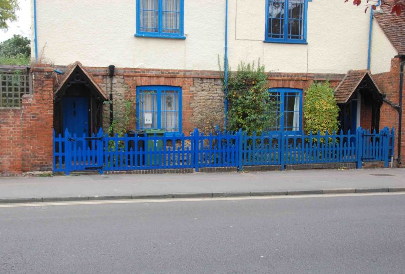
752 BATH STREET
(East Side)
SU 4997 1/51A Fence and gate to
Nos 55 and 57
II
2.
Arrowheaded full and half standard wooden fence and gate.
Listing NGR: SU4954997339
External links are from the relevant listing authority and, where applicable, Wikidata. Wikidata IDs may be related buildings as well as this specific building. If you want to add or update a link, you will need to do so by editing the Wikidata entry.


Other nearby listed buildings
