Approximate Location Map
Large Map »
Latitude: 51.6689 / 51°40'8"N
Longitude: -1.2951 / 1°17'42"W
OS Eastings: 448842
OS Northings: 196917
OS Grid: SU488969
Mapcode National: GBR 7YQ.9CP
Mapcode Global: VHCY6.H9NY
Plus Code: 9C3WMP93+HW
Entry Name: Ock Bridge
Listing Date: 10 December 1971
Grade: II
Source: Historic England
Source ID: 1048827
English Heritage Legacy ID: 250473
ID on this website: 101048827
Location: Caldecott, Vale of White Horse, Oxfordshire, OX14
County: Oxfordshire
District: Vale of White Horse
Civil Parish: Abingdon on Thames
Built-Up Area: Abingdon
Traditional County: Berkshire
Lieutenancy Area (Ceremonial County): Oxfordshire
Church of England Parish: Abingdon-on-Thames
Church of England Diocese: Oxford
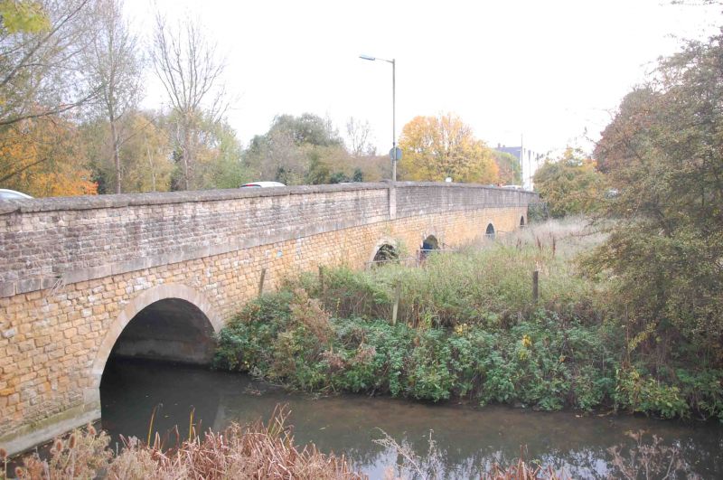
1.
752 OCK STREET
(South Side)
SU 4896 1/318 Ock Bridge
II
2.
Originally C15, rubble, altered and widened on west. Seven arches, one
with original ribs. (See E Jervoise, "Ancient Bridges of the South of
England" (1930) p 7 VCH. Berks IV, p 434) A.M.
Listing NGR: SU4884296917
External links are from the relevant listing authority and, where applicable, Wikidata. Wikidata IDs may be related buildings as well as this specific building. If you want to add or update a link, you will need to do so by editing the Wikidata entry.


Other nearby listed buildings
