Approximate Location Map
Large Map »
Latitude: 51.6717 / 51°40'18"N
Longitude: -1.2844 / 1°17'3"W
OS Eastings: 449580
OS Northings: 197236
OS Grid: SU495972
Mapcode National: GBR 7YR.043
Mapcode Global: VHCY6.P7BS
Plus Code: 9C3WMPC8+M6
Entry Name: 1, Park Road
Listing Date: 10 December 1971
Grade: II
Source: Historic England
Source ID: 1048830
English Heritage Legacy ID: 250476
ID on this website: 101048830
Location: Abingdon-on-Thames, Vale of White Horse, Oxfordshire, OX14
County: Oxfordshire
District: Vale of White Horse
Civil Parish: Abingdon on Thames
Built-Up Area: Abingdon
Traditional County: Berkshire
Lieutenancy Area (Ceremonial County): Oxfordshire
Church of England Parish: Abingdon-on-Thames
Church of England Diocese: Oxford
Tagged with: Building
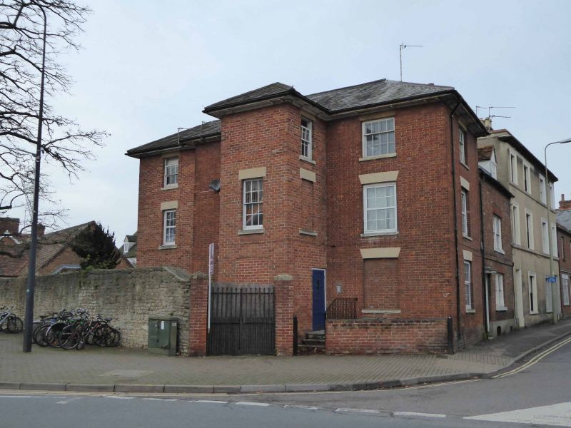
1.
752 PARK ROAD
SU 4997 1/388 No. 1
II
2.
Early C19. Brick, Hipped slate roof. Three storeys. Three windows,
one blocked, double hung sashes with glazing bars, stone lintels. Six
panel door (two glass), plain wood hood on carved brackets. Two steps.
To left, pentice extension of one storey with one sliding sash window.
Listing NGR: SU4958097236
External links are from the relevant listing authority and, where applicable, Wikidata. Wikidata IDs may be related buildings as well as this specific building. If you want to add or update a link, you will need to do so by editing the Wikidata entry.


Other nearby listed buildings
