Approximate Location Map
Large Map »
Latitude: 51.5846 / 51°35'4"N
Longitude: -1.4772 / 1°28'37"W
OS Eastings: 436318
OS Northings: 187434
OS Grid: SU363874
Mapcode National: GBR 6Y3.R9Z
Mapcode Global: VHC11.BFXL
Plus Code: 9C3WHGMF+R4
Entry Name: Cressbed Cottage
Listing Date: 25 October 1951
Grade: II
Source: Historic England
Source ID: 1198147
English Heritage Legacy ID: 250695
ID on this website: 101198147
Location: Childrey, Vale of White Horse, Oxfordshire, OX12
County: Oxfordshire
District: Vale of White Horse
Civil Parish: Childrey
Built-Up Area: Childrey
Traditional County: Berkshire
Lieutenancy Area (Ceremonial County): Oxfordshire
Tagged with: Cottage Thatched cottage
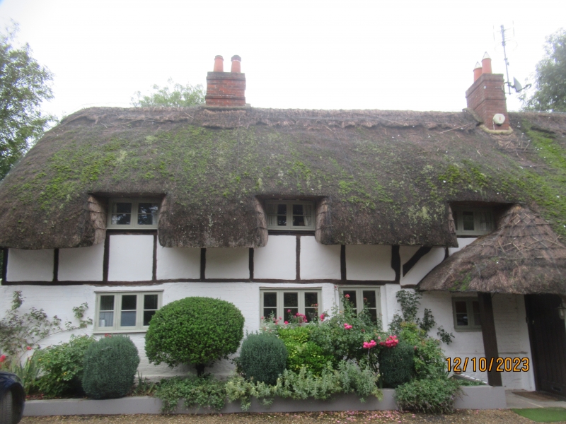
CHILDREY STOW HILL
SU3687 (North side)
12/67 Cressbed Cottage
25/10/51
GV II
Farmhouse, now house. Mid/late C17. Timber framed in square framing with
diagonal braces and brick infill; thatched roof; brick stacks. Lobby-entry plan
form not deducible. 1 1/2-storey, 5-window range. C20 porch and casements;
half-hipped roof, 2 ridge stacks.
Listing NGR: SU3631887434
External links are from the relevant listing authority and, where applicable, Wikidata. Wikidata IDs may be related buildings as well as this specific building. If you want to add or update a link, you will need to do so by editing the Wikidata entry.


Other nearby listed buildings
