Approximate Location Map
Large Map »
Latitude: 51.6244 / 51°37'27"N
Longitude: -1.4503 / 1°27'0"W
OS Eastings: 438151
OS Northings: 191872
OS Grid: SU381918
Mapcode National: GBR 6XS.063
Mapcode Global: VHC0V.TF5L
Plus Code: 9C3WJGFX+QV
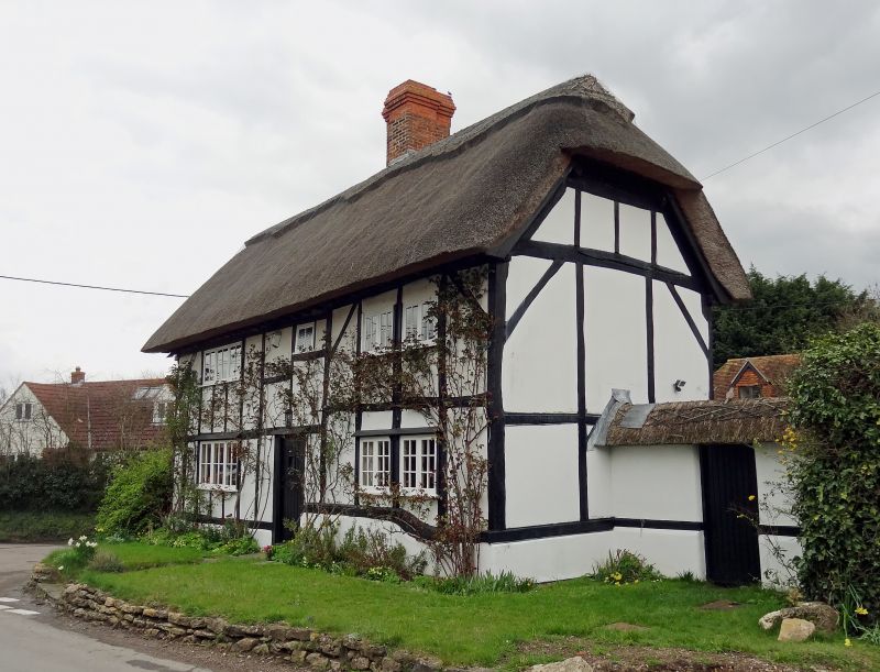
Entry Name: Magpie Cottage
Listing Date: 6 December 1985
Grade: II
Source: Historic England
Source ID: 1182400
English Heritage Legacy ID: 251106
ID on this website: 101182400
Location: Denchworth, Vale of White Horse, Oxfordshire, OX12
County: Oxfordshire
District: Vale of White Horse
Civil Parish: Denchworth
Traditional County: Berkshire
Lieutenancy Area (Ceremonial County): Oxfordshire
Tagged with: Cottage
DENCHWORTH HYDE ROAD
SU39SE (East side)
1/12 Magpie Cottage
GV II
House. C17. Square/rectangular timber framing; no roof at time of survey; stone
stack finished in brick. 2-unit lobby-entry plan. 2 storeys; 3-window range. C20
door and casements. Ridge stack. Interior: Plain beams and joists; exposed
timber framing; original roof destroyed by fire.
Listing NGR: SU3815191872
External links are from the relevant listing authority and, where applicable, Wikidata. Wikidata IDs may be related buildings as well as this specific building. If you want to add or update a link, you will need to do so by editing the Wikidata entry.


Other nearby listed buildings
