Approximate Location Map
Large Map »
Latitude: 51.5902 / 51°35'24"N
Longitude: -1.4246 / 1°25'28"W
OS Eastings: 439958
OS Northings: 188083
OS Grid: SU399880
Mapcode National: GBR 6Y6.6N2
Mapcode Global: VHC12.8979
Plus Code: 9C3WHHRG+35
Entry Name: 57, Grove Street
Listing Date: 6 December 1985
Grade: II
Source: Historic England
Source ID: 1048537
English Heritage Legacy ID: 251179
ID on this website: 101048537
Location: Wantage, Vale of White Horse, Oxfordshire, OX12
County: Oxfordshire
District: Vale of White Horse
Civil Parish: Wantage
Built-Up Area: Wantage
Traditional County: Berkshire
Lieutenancy Area (Ceremonial County): Oxfordshire
Tagged with: Building
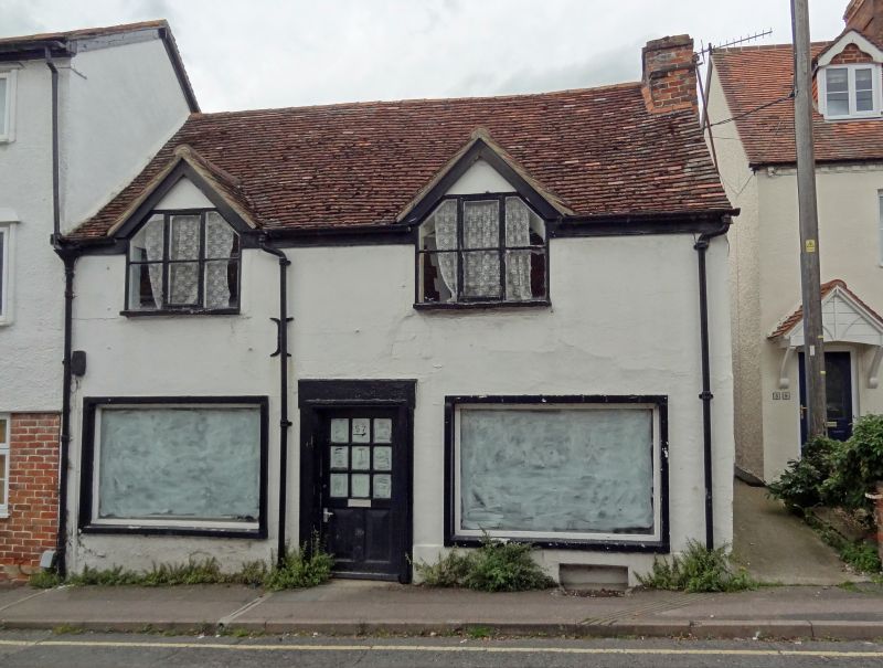
WANTAGE GROVE STREET
SU3988 (West side)
6/84 No.57
GV II
House, now salon. Probably C15 hall, floored over in early C17. Imitation stone
ashlar front, rendered side walls; old tile roof; brick stack. Single-unit plan.
2 storeys; 2-window range. Mid C20 front has C20 door and casements. Gabled
roof; gable end stack to right. Interior: Chamfered C17 beams and joists in
ground floor. 2-bay full-cruck roof.
Listing NGR: SU3995888083
External links are from the relevant listing authority and, where applicable, Wikidata. Wikidata IDs may be related buildings as well as this specific building. If you want to add or update a link, you will need to do so by editing the Wikidata entry.


Other nearby listed buildings
