Approximate Location Map
Large Map »
Latitude: 51.7662 / 51°45'58"N
Longitude: -1.5666 / 1°33'59"W
OS Eastings: 430002
OS Northings: 207587
OS Grid: SP300075
Mapcode National: GBR 5TK.6R6
Mapcode Global: VHC00.SVNY
Plus Code: 9C3WQC8M+F8
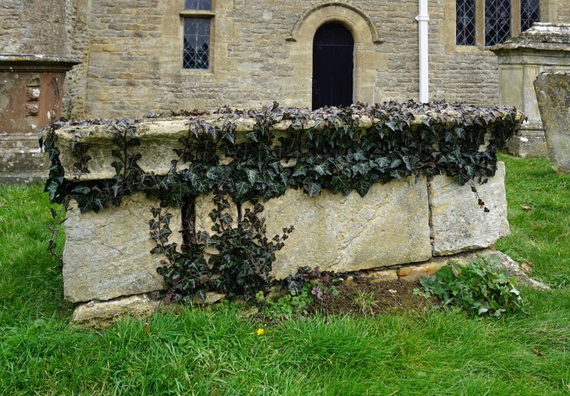
Entry Name: Chest Tomb Approximately 5 Metres South of Chancel of Church of St Britius
Listing Date: 17 October 1988
Grade: II
Source: Historic England
Source ID: 1284305
English Heritage Legacy ID: 252115
ID on this website: 101284305
Location: Brize Norton, West Oxfordshire, OX18
County: Oxfordshire
District: West Oxfordshire
Civil Parish: Brize Norton
Built-Up Area: Brize Norton
Traditional County: Oxfordshire
Lieutenancy Area (Ceremonial County): Oxfordshire
Church of England Parish: Brize Norton
Church of England Diocese: Oxford
Tagged with: Chest tomb
BRIZE NORTON STATION ROAD
SP3007 (West side)
17/43 Chest tomb approx. 5m. S of
chancel of Church of St.
Britius
GV II
Chest tomb. Date 1716. Limestone. Plain with splayed plinth and cornice.
Listing NGR: SP3000207587
External links are from the relevant listing authority and, where applicable, Wikidata. Wikidata IDs may be related buildings as well as this specific building. If you want to add or update a link, you will need to do so by editing the Wikidata entry.


Other nearby listed buildings
