Approximate Location Map
Large Map »
Latitude: 51.7488 / 51°44'55"N
Longitude: -1.3997 / 1°23'58"W
OS Eastings: 441540
OS Northings: 205741
OS Grid: SP415057
Mapcode National: GBR 7XM.6Z8
Mapcode Global: VHC09.P9DP
Plus Code: 9C3WPJX2+G4
Entry Name: Stocks Approximately 30 Metres North East of the Harcourt Arms Public House
Listing Date: 17 October 1988
Grade: II
Source: Historic England
Source ID: 1367877
English Heritage Legacy ID: 252394
ID on this website: 101367877
Location: Stanton Harcourt, West Oxfordshire, OX29
County: Oxfordshire
District: West Oxfordshire
Civil Parish: Stanton Harcourt
Built-Up Area: Stanton Harcourt
Traditional County: Oxfordshire
Lieutenancy Area (Ceremonial County): Oxfordshire
Church of England Parish: Stanton Harcourt
Church of England Diocese: Oxford
Tagged with: Stocks
STANTON HARCOURT
SP4105
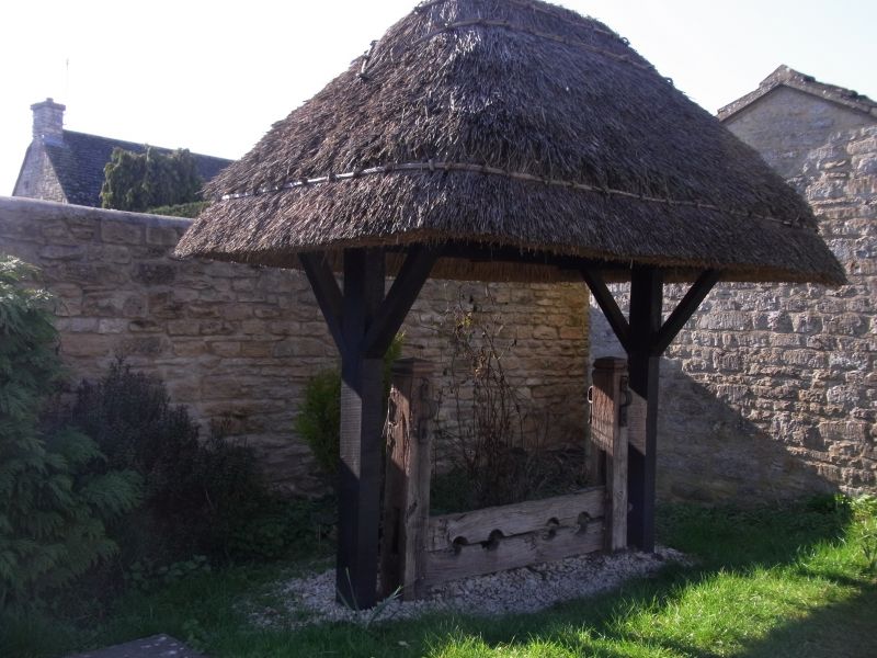
21/310 Stocks approx. 30m. NE of The
Harcourt Arms Public House
GV II
Stocks. C18. Oak. Four leg-holes, and turned tops to posts.
Listing NGR: SP4154005741
External links are from the relevant listing authority and, where applicable, Wikidata. Wikidata IDs may be related buildings as well as this specific building. If you want to add or update a link, you will need to do so by editing the Wikidata entry.


Other nearby listed buildings
