Approximate Location Map
Large Map »
Latitude: 51.8152 / 51°48'54"N
Longitude: -1.6266 / 1°37'35"W
OS Eastings: 425833
OS Northings: 213022
OS Grid: SP258130
Mapcode National: GBR 5SW.3LD
Mapcode Global: VHBZS.RMFS
Plus Code: 9C3WR98F+38
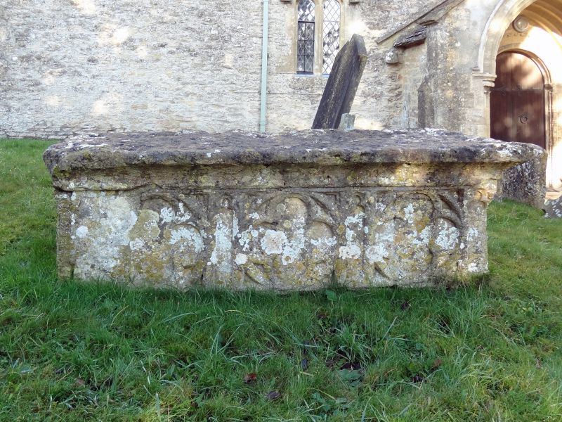
Entry Name: Medieval Chest Tomb Approximately 5 Metres South of Tower of Church of St James the Great
Listing Date: 21 August 1989
Grade: II*
Source: Historic England
Source ID: 1053491
English Heritage Legacy ID: 253603
ID on this website: 101053491
Location: St James Church, Fulbrook, West Oxfordshire, OX18
County: Oxfordshire
District: West Oxfordshire
Civil Parish: Fulbrook
Traditional County: Oxfordshire
Lieutenancy Area (Ceremonial County): Oxfordshire
Church of England Parish: Fulbrook
Church of England Diocese: Oxford
Tagged with: Chest tomb
FULBROOK
SP2513
11/46
CHURCH LANE
(East side)
Medieval chest tomb approx. 5m
S of tower of Church of St.
James the Great
GV
II*
Chest tomb. Probably C15. Stone. Tracery panels to sides and ends. Flat top
slab.
Listing NGR: SP2583313022
External links are from the relevant listing authority and, where applicable, Wikidata. Wikidata IDs may be related buildings as well as this specific building. If you want to add or update a link, you will need to do so by editing the Wikidata entry.


Other nearby listed buildings
