Approximate Location Map
Large Map »
Latitude: 51.8142 / 51°48'51"N
Longitude: -1.6263 / 1°37'34"W
OS Eastings: 425859
OS Northings: 212911
OS Grid: SP258129
Mapcode National: GBR 5SW.9MV
Mapcode Global: VHBZS.RNMK
Plus Code: 9C3WR97F+MF
Entry Name: Wynfield
Listing Date: 21 August 1989
Grade: II
Source: Historic England
Source ID: 1367708
English Heritage Legacy ID: 253611
ID on this website: 101367708
Location: Fulbrook, West Oxfordshire, OX18
County: Oxfordshire
District: West Oxfordshire
Civil Parish: Fulbrook
Traditional County: Oxfordshire
Lieutenancy Area (Ceremonial County): Oxfordshire
Church of England Parish: Fulbrook
Church of England Diocese: Oxford
Tagged with: Building
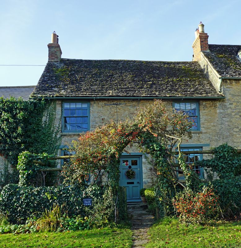
FULBROOK MEADOW LANE
SF2512 (West side)
12/54 Wynfield
GV II
House. Late C18. Stone coursed rubble; stone slate roof; brick end stack to
left. 2-storey, 2-window range. 6-panel part-glazed door to centre with wood
lintel. 16-pane unhorned sashes to ground' floor left and right, and to first
floor. Interior not inspected.
Listing NGR: SP2585912911
External links are from the relevant listing authority and, where applicable, Wikidata. Wikidata IDs may be related buildings as well as this specific building. If you want to add or update a link, you will need to do so by editing the Wikidata entry.


Other nearby listed buildings
