Approximate Location Map
Large Map »
Latitude: 51.8234 / 51°49'24"N
Longitude: -1.666 / 1°39'57"W
OS Eastings: 423118
OS Northings: 213912
OS Grid: SP231139
Mapcode National: GBR 5SM.RLZ
Mapcode Global: VHBZS.2FMK
Plus Code: 9C3WR8FM+8J
Entry Name: Upper Farmhouse
Listing Date: 12 September 1955
Grade: II
Source: Historic England
Source ID: 1053422
English Heritage Legacy ID: 253739
ID on this website: 101053422
Location: Taynton, West Oxfordshire, OX18
County: Oxfordshire
District: West Oxfordshire
Civil Parish: Taynton
Traditional County: Oxfordshire
Lieutenancy Area (Ceremonial County): Oxfordshire
Church of England Parish: Taynton
Church of England Diocese: Oxford
Tagged with: Farmhouse
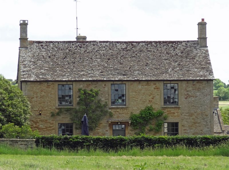
TAYNTON
SP2313
10/181
Upper Farmhouse
12.09.55
GV II
Farmhouse. Late C18. Coursed rubble; stone slate roof; stone end stacks.
2-storey, 3-window range. Panelled door to centre with overlight and flat
hood on stone brackets. 16-pane unhorned sashes to all openings. Interior
not inspected.
Listing NGR: SP2311813912
External links are from the relevant listing authority and, where applicable, Wikidata. Wikidata IDs may be related buildings as well as this specific building. If you want to add or update a link, you will need to do so by editing the Wikidata entry.


Other nearby listed buildings
