Approximate Location Map
Large Map »
Latitude: 51.9602 / 51°57'36"N
Longitude: -1.6396 / 1°38'22"W
OS Eastings: 424862
OS Northings: 229140
OS Grid: SP248291
Mapcode National: GBR 5R4.095
Mapcode Global: VHBZ0.JZLP
Plus Code: 9C3WX966+35
Entry Name: Garden Wall, Gate Piers and Steps to North and East of Chastleton House
Listing Date: 15 May 1989
Grade: II
Source: Historic England
Source ID: 1198045
English Heritage Legacy ID: 253912
ID on this website: 101198045
Location: Chastleton, West Oxfordshire, GL56
County: Oxfordshire
District: West Oxfordshire
Civil Parish: Chastleton
Traditional County: Oxfordshire
Lieutenancy Area (Ceremonial County): Oxfordshire
Church of England Parish: Little Compton, Chastleton, Cornwell, Little Rollright and Salford
Church of England Diocese: Oxford
Tagged with: Wall
CHASTLETON
5P2429-2529
11/23 Garden wall, gate piers and
steps to N and E of Chastleton
House
GV II
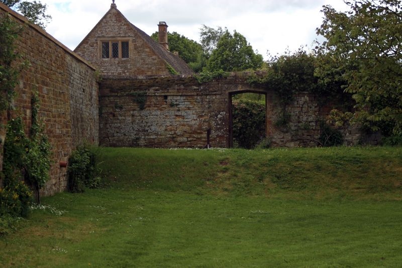
Garden wall, gate piers and steps. Wall. Probably early C17 with later repairs.
Regularly coursed and dressed marlstone with ashlar and rounded rubble coping.
From point where it meets garden wall to south of Chastleton House (q.v.) it
runs along north side of churchyard of Church of St. Mary (q.v.) and then turns
at right-angles to form boundary of garden to east of Chastleton House. This
section has two C18 gate piers with moulded capping and ball finials. The wall
then takes another right-angled turn to separate upper and lower gardens. To
north-west of section returning to join north-east corner of house are 2 sets of
straight-flight steps with square piers, which have moulded capping and ball
finials. A section of wall linked to west side of house runs northwards along
road to join The Dower House (q.v.): the section nearest The Dower House is
buttressed and has a 4-centred chamfered arch at the point where it joins the
house.
[2464]
Listing NGR: SP2486229140
External links are from the relevant listing authority and, where applicable, Wikidata. Wikidata IDs may be related buildings as well as this specific building. If you want to add or update a link, you will need to do so by editing the Wikidata entry.


Other nearby listed buildings
