Approximate Location Map
Large Map »
Latitude: 52.4581 / 52°27'29"N
Longitude: -2.3553 / 2°21'19"W
OS Eastings: 375955
OS Northings: 284525
OS Grid: SO759845
Mapcode National: GBR 09B.Z6Z
Mapcode Global: VH91D.4G6Y
Plus Code: 9C4VFJ5V+7V
Entry Name: Churchyard Cross
Listing Date: 1 February 1974
Grade: II
Source: Historic England
Source ID: 1367870
English Heritage Legacy ID: 254281
ID on this website: 101367870
Location: St Mary's Church, Alveley, Shropshire, WV15
County: Shropshire
Civil Parish: Alveley
Built-Up Area: Alveley
Traditional County: Shropshire
Lieutenancy Area (Ceremonial County): Shropshire
Church of England Parish: Alveley
Church of England Diocese: Hereford
Tagged with: Churchyard cross
1.
1954
SO 78 SE
33/2
ALVELEY
ALVELEY
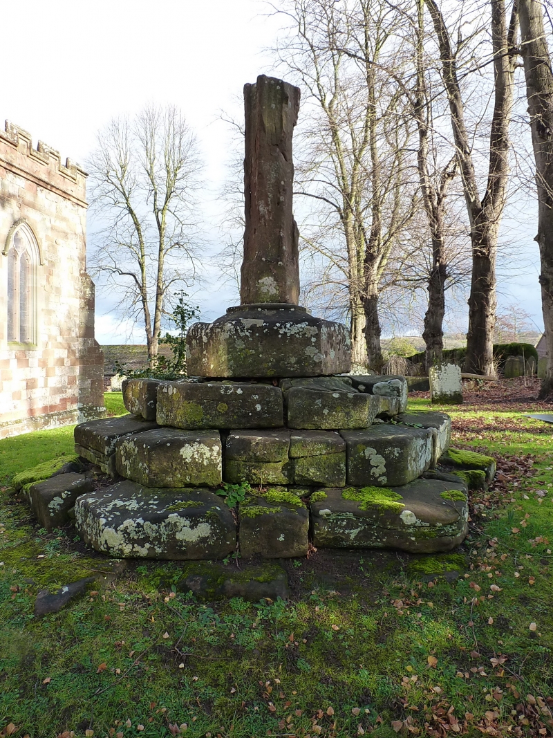
Churchyard Cross
II
GV
2.
A headless truncated stone shaft raised on a base and three stone steps,
sexagonal on plan.
Church of St Mary. Churchyard Cross and walls, and all the buildings in
Centre Place form a group.
Listing NGR: SO7595584525
External links are from the relevant listing authority and, where applicable, Wikidata. Wikidata IDs may be related buildings as well as this specific building. If you want to add or update a link, you will need to do so by editing the Wikidata entry.


Other nearby listed buildings
