Approximate Location Map
Large Map »
Latitude: 52.456 / 52°27'21"N
Longitude: -2.3535 / 2°21'12"W
OS Eastings: 376074
OS Northings: 284289
OS Grid: SO760842
Mapcode National: GBR 09B.ZSH
Mapcode Global: VH91D.5J4K
Plus Code: 9C4VFJ4W+CH
Entry Name: 50-53, Ivy Place
Listing Date: 1 February 1974
Grade: II
Source: Historic England
Source ID: 1053197
English Heritage Legacy ID: 254293
ID on this website: 101053197
Location: Alveley, Shropshire, WV15
County: Shropshire
Civil Parish: Alveley
Built-Up Area: Alveley
Traditional County: Shropshire
Lieutenancy Area (Ceremonial County): Shropshire
Church of England Parish: Alveley
Church of England Diocese: Hereford
Tagged with: Building
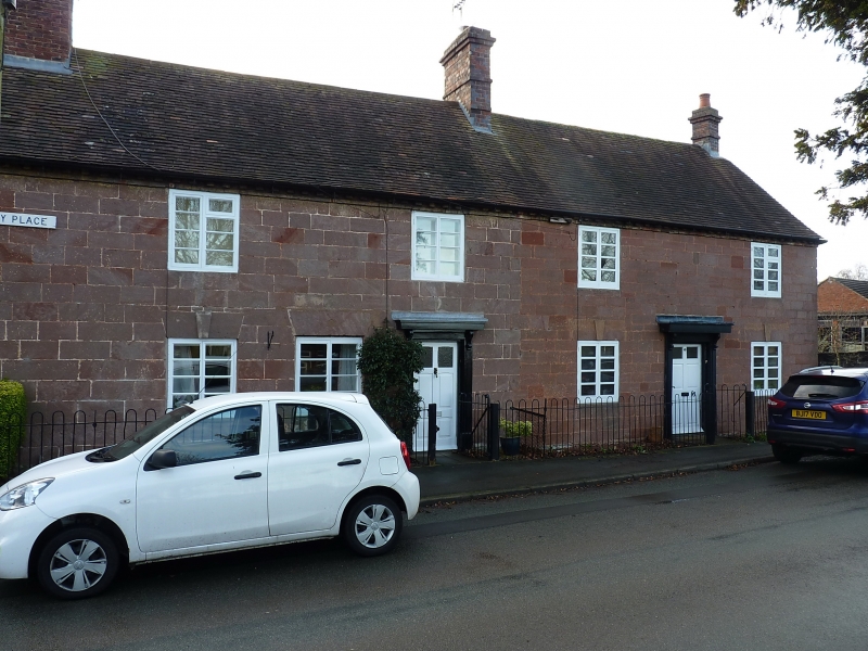
1.
1954 ALVELEY ALVELEY
IVY PLACE
Nos 50 to 53 (consec)
SO 78 SE 33/15
II
2.
C18 to C19. Coursed sandstone rubble; plaintile roofs; brick stacks.
Block of 4 cottages. 2-storey; 2 windows per cottage, wood casements,
keyblocks to ground floor openings; plain doors under shallow moulded
ledge hoods on brackets.
Listing NGR: SO7607484289
External links are from the relevant listing authority and, where applicable, Wikidata. Wikidata IDs may be related buildings as well as this specific building. If you want to add or update a link, you will need to do so by editing the Wikidata entry.


Other nearby listed buildings
