Approximate Location Map
Large Map »
Latitude: 52.5341 / 52°32'2"N
Longitude: -2.4202 / 2°25'12"W
OS Eastings: 371592
OS Northings: 292999
OS Grid: SO715929
Mapcode National: GBR BZ.FDWR
Mapcode Global: VH90Z.0KDQ
Plus Code: 9C4VGHMH+JW
Entry Name: Fragment of Town Walls to West of Postern Gate
Listing Date: 1 February 1974
Grade: II
Source: Historic England
Source ID: 1307616
English Heritage Legacy ID: 254342
ID on this website: 101307616
Location: Bridgnorth, Shropshire, WV16
County: Shropshire
Civil Parish: Bridgnorth
Built-Up Area: Bridgnorth
Traditional County: Shropshire
Lieutenancy Area (Ceremonial County): Shropshire
Church of England Parish: Bridgnorth
Church of England Diocese: Hereford
Tagged with: Architectural structure
1.
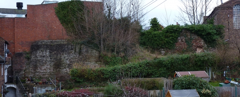
1954 BRIDGNORTH
Fragment of Town Walls
to west of Postern Gate
SO 79 SW 1 and 2/3
II
2.
Probably C13. A section of sandstone rubble wall, approximately 6 yds.
in length and 15 ft. high on its west side.
Listing NGR: SO7159292999
External links are from the relevant listing authority and, where applicable, Wikidata. Wikidata IDs may be related buildings as well as this specific building. If you want to add or update a link, you will need to do so by editing the Wikidata entry.


Other nearby listed buildings
