Approximate Location Map
Large Map »
Latitude: 52.5346 / 52°32'4"N
Longitude: -2.4192 / 2°25'8"W
OS Eastings: 371664
OS Northings: 293049
OS Grid: SO716930
Mapcode National: GBR BZ.FF4K
Mapcode Global: VH90Z.0KYC
Plus Code: 9C4VGHMJ+R8
Entry Name: 8A, Bank Street
Listing Date: 1 February 1974
Grade: II
Source: Historic England
Source ID: 1307617
English Heritage Legacy ID: 254344
ID on this website: 101307617
Location: Bridgnorth, Shropshire, WV16
County: Shropshire
Civil Parish: Bridgnorth
Built-Up Area: Bridgnorth
Traditional County: Shropshire
Lieutenancy Area (Ceremonial County): Shropshire
Church of England Parish: Bridgnorth
Church of England Diocese: Hereford
Tagged with: Building
1.
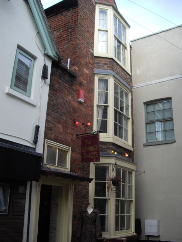
1954 BRIDGNORTH
BANK STREET
No 8A
SO 79 SW 2/5
II
2.
Early C19. Red brick; plain gabled front of 3 storeys with a three-light
canted bay window tiered over three storeys; moulded wood doorcase with
cornice hood.
Listing NGR: SO7166493049
External links are from the relevant listing authority and, where applicable, Wikidata. Wikidata IDs may be related buildings as well as this specific building. If you want to add or update a link, you will need to do so by editing the Wikidata entry.


Other nearby listed buildings
