Approximate Location Map
Large Map »
Latitude: 52.5345 / 52°32'4"N
Longitude: -2.4172 / 2°25'1"W
OS Eastings: 371800
OS Northings: 293043
OS Grid: SO718930
Mapcode National: GBR BZ.FFMX
Mapcode Global: VH90Z.2K0D
Plus Code: 9C4VGHMM+R4
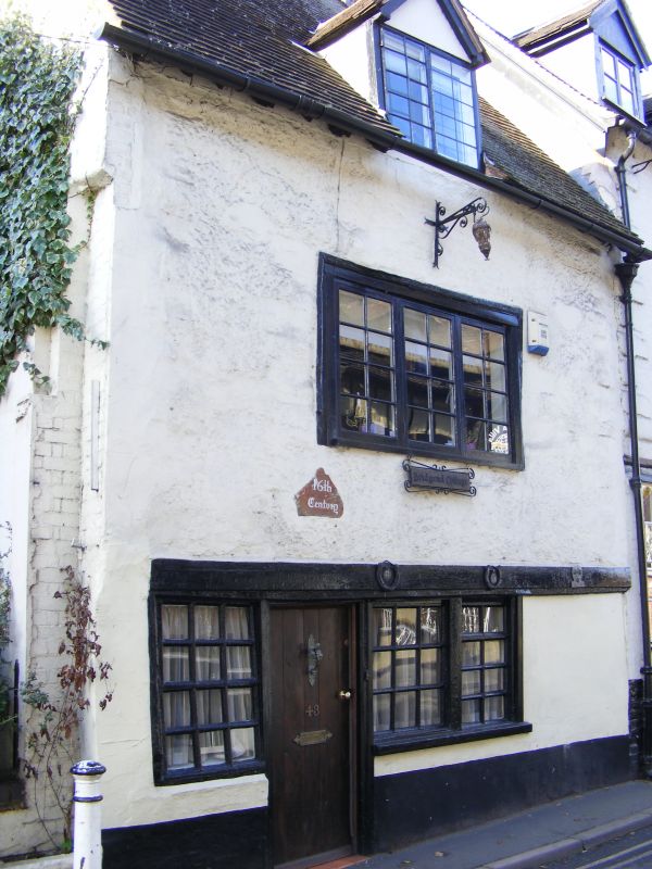
Entry Name: 43, CARTWAY (See details for further address information)
Listing Date: 9 March 1970
Grade: II
Source: Historic England
Source ID: 1367866
English Heritage Legacy ID: 254370
ID on this website: 101367866
Location: Low Town, Shropshire, WV16
County: Shropshire
Civil Parish: Bridgnorth
Built-Up Area: Bridgnorth
Traditional County: Shropshire
Lieutenancy Area (Ceremonial County): Shropshire
Church of England Parish: Bridgnorth
Church of England Diocese: Hereford
Tagged with: Building
1.
1954 BRIDGNORTH
CARTWAY
(South and
West Side)
No 45
SO 79 SW 2/32 9.3.70.
II GV
2.
Early C18. Stucco; 2 storeys; defaced quoins; 1 sash window; simple doorway
with adjoining sashes and plain wood cornice above; 1 gabled dormer; old
tiles.
Nos 34 to 43 (consec) form a group
Listing NGR: SO7180093043
External links are from the relevant listing authority and, where applicable, Wikidata. Wikidata IDs may be related buildings as well as this specific building. If you want to add or update a link, you will need to do so by editing the Wikidata entry.


Other nearby listed buildings
