Approximate Location Map
Large Map »
Latitude: 52.5357 / 52°32'8"N
Longitude: -2.4176 / 2°25'3"W
OS Eastings: 371770
OS Northings: 293179
OS Grid: SO717931
Mapcode National: GBR BZ.F7K9
Mapcode Global: VH90Z.1JRG
Plus Code: 9C4VGHPJ+7X
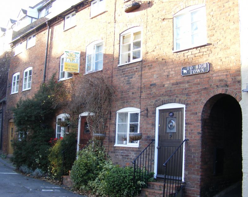
Entry Name: 69-71, CARTWAY (See details for further address information)
Listing Date: 9 March 1970
Grade: II
Source: Historic England
Source ID: 1053982
English Heritage Legacy ID: 254383
ID on this website: 101053982
Location: Bridgnorth, Shropshire, WV16
County: Shropshire
Civil Parish: Bridgnorth
Built-Up Area: Bridgnorth
Traditional County: Shropshire
Lieutenancy Area (Ceremonial County): Shropshire
Church of England Parish: Bridgnorth
Church of England Diocese: Hereford
Tagged with: Building
1.
1954 BRIDGNORTH
CARTWAY
(East and
North Side)
Nos 69 to 71 (consec)
SO 79 SW 2/45 9.3.70.
II
2.
Late C18. Red brick; 3 storeys; 3 casement windows; 3 plain doorways
with plank doors; old tiles.
Listing NGR: SO7177093179
External links are from the relevant listing authority and, where applicable, Wikidata. Wikidata IDs may be related buildings as well as this specific building. If you want to add or update a link, you will need to do so by editing the Wikidata entry.


Other nearby listed buildings
