Approximate Location Map
Large Map »
Latitude: 52.5322 / 52°31'55"N
Longitude: -2.4194 / 2°25'9"W
OS Eastings: 371647
OS Northings: 292781
OS Grid: SO716927
Mapcode National: GBR BZ.FF36
Mapcode Global: VH90Z.0MT6
Plus Code: 9C4VGHJJ+V6
Entry Name: The Castle
Listing Date: 18 July 1949
Grade: II
Source: Historic England
Source ID: 1053985
English Heritage Legacy ID: 254386
ID on this website: 101053985
Location: The Castle Grounds, Castle Hill, Shropshire, WV16
County: Shropshire
Civil Parish: Bridgnorth
Built-Up Area: Bridgnorth
Traditional County: Shropshire
Lieutenancy Area (Ceremonial County): Shropshire
Church of England Parish: Bridgnorth
Church of England Diocese: Hereford
SO 79 SW
1/48
BRIDGNORTH
CASTLE GREEN
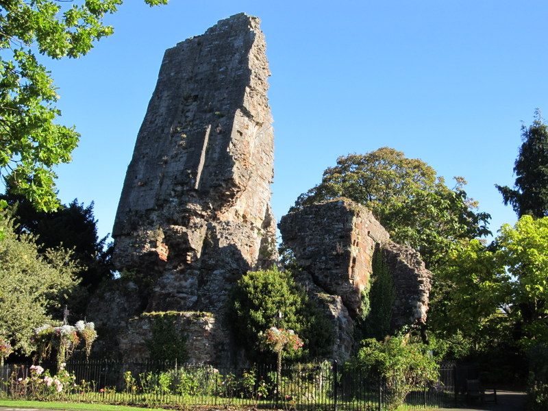
The Castle
18.07.49
II
Only the Keep, a massive ruinous tower of circa 1200 remains with a fragment of the curtain wall extending from the south wall. The Keep leans at an angle of 75 degrees from vertical. AM.
Listing NGR: SO7164792781
External links are from the relevant listing authority and, where applicable, Wikidata. Wikidata IDs may be related buildings as well as this specific building. If you want to add or update a link, you will need to do so by editing the Wikidata entry.


Other nearby listed buildings
