Approximate Location Map
Large Map »
Latitude: 52.5346 / 52°32'4"N
Longitude: -2.4185 / 2°25'6"W
OS Eastings: 371706
OS Northings: 293051
OS Grid: SO717930
Mapcode National: GBR BZ.FF8X
Mapcode Global: VH90Z.1K8B
Plus Code: 9C4VGHMJ+RH
Entry Name: 7, Castle Terrace
Listing Date: 9 March 1970
Grade: II
Source: Historic England
Source ID: 1367496
English Heritage Legacy ID: 254388
ID on this website: 101367496
Location: Bridgnorth, Shropshire, WV16
County: Shropshire
Civil Parish: Bridgnorth
Built-Up Area: Bridgnorth
Traditional County: Shropshire
Lieutenancy Area (Ceremonial County): Shropshire
Church of England Parish: Bridgnorth
Church of England Diocese: Hereford
Tagged with: Building
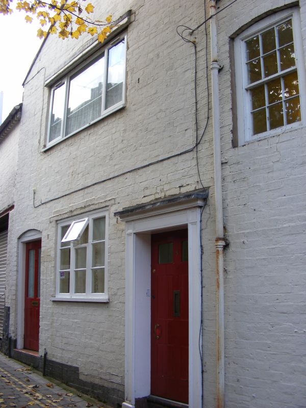
1.
1954 BRIDGNORTH
CASTLE TERRACE
No 7
SO 79 SW 2/50 9.3.70.
II
2.
C18. Painted brick; 2 storeys; 2 sash windows with cambered heads; moulded
wood pilaster doorcase with small cornice hood; tiles.
Listing NGR: SO7170693051
External links are from the relevant listing authority and, where applicable, Wikidata. Wikidata IDs may be related buildings as well as this specific building. If you want to add or update a link, you will need to do so by editing the Wikidata entry.


Other nearby listed buildings
