Approximate Location Map
Large Map »
Latitude: 52.5337 / 52°32'1"N
Longitude: -2.4189 / 2°25'8"W
OS Eastings: 371678
OS Northings: 292950
OS Grid: SO716929
Mapcode National: GBR BZ.FF5Z
Mapcode Global: VH90Z.1L11
Plus Code: 9C4VGHMJ+FC
Entry Name: 10, East Castle Street
Listing Date: 18 July 1949
Grade: II
Source: Historic England
Source ID: 1053991
English Heritage Legacy ID: 254397
ID on this website: 101053991
Location: Castle Hill, Shropshire, WV16
County: Shropshire
Civil Parish: Bridgnorth
Built-Up Area: Bridgnorth
Traditional County: Shropshire
Lieutenancy Area (Ceremonial County): Shropshire
Church of England Parish: Bridgnorth
Church of England Diocese: Hereford
Tagged with: Building
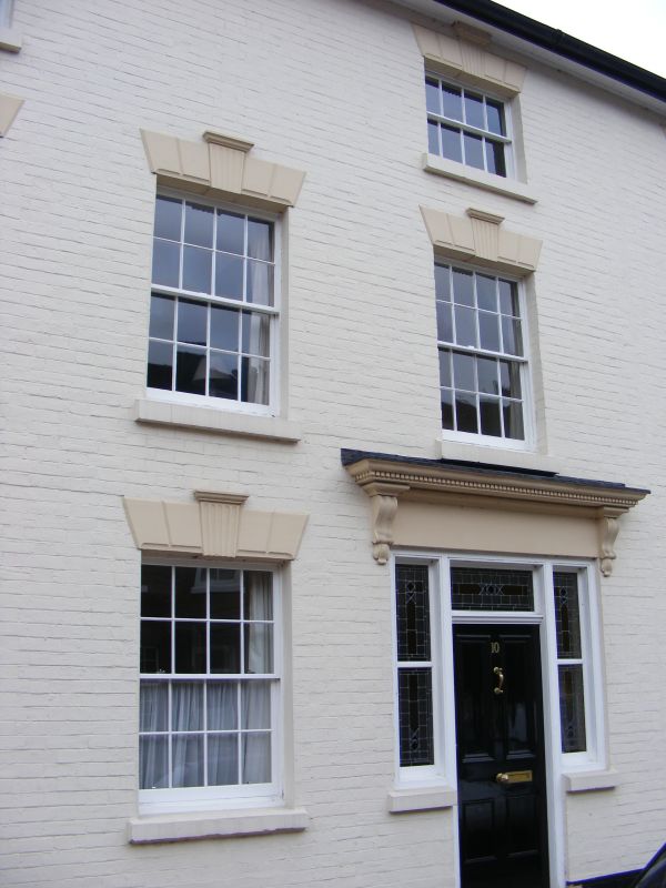
1.
1954 BRIDGNORTH
EAST CASTLE STREET
(West Side)
No 10
SO 79 SW 1/59 18.7.49.
II GV
2.
Early C19. Painted brick; 3 storeys; 4 Sash windows with channelled lintels
and keyblocks; 3 windows to ground floor; simple doorcase with dentllied
stone cornice on console brackets above; plain eaves; tiles.
Nos 10 to 16 (consec) and St Mary's Church form a group
Listing NGR: SO7167892950
External links are from the relevant listing authority and, where applicable, Wikidata. Wikidata IDs may be related buildings as well as this specific building. If you want to add or update a link, you will need to do so by editing the Wikidata entry.


Other nearby listed buildings
