Approximate Location Map
Large Map »
Latitude: 52.5367 / 52°32'12"N
Longitude: -2.4207 / 2°25'14"W
OS Eastings: 371560
OS Northings: 293291
OS Grid: SO715932
Mapcode National: GBR BZ.F6RJ
Mapcode Global: VH90Z.0H3P
Plus Code: 9C4VGHPH+MP
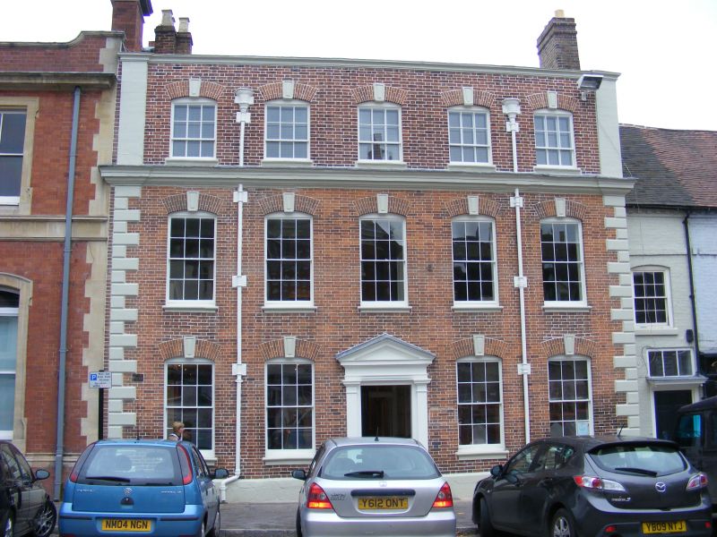
Entry Name: Northgate House
Listing Date: 18 July 1949
Grade: II
Source: Historic England
Source ID: 1177434
English Heritage Legacy ID: 254423
ID on this website: 101177434
Location: High Town, Shropshire, WV16
County: Shropshire
Civil Parish: Bridgnorth
Built-Up Area: Bridgnorth
Traditional County: Shropshire
Lieutenancy Area (Ceremonial County): Shropshire
Church of England Parish: Bridgnorth
Church of England Diocese: Hereford
Tagged with: House
SO 79 SW
2/86
BRIDGNORTH
HIGH STREET (West Side),
No 7 (Northgate House)
18.07.49
GV
II
Circa 1750. Red brick; three storeys; five sash windows with keyblocks and moulded sills; moulded stone cornice at second floor; quoins; parapet; moulded wood doorcase with pediment on Tuscan pilasters.
Nos 3 to 7 (consec) form a group
Listing NGR: SO7156093291
External links are from the relevant listing authority and, where applicable, Wikidata. Wikidata IDs may be related buildings as well as this specific building. If you want to add or update a link, you will need to do so by editing the Wikidata entry.


Other nearby listed buildings
