Approximate Location Map
Large Map »
Latitude: 52.5364 / 52°32'10"N
Longitude: -2.4204 / 2°25'13"W
OS Eastings: 371579
OS Northings: 293252
OS Grid: SO715932
Mapcode National: GBR BZ.F6TT
Mapcode Global: VH90Z.0H8Y
Plus Code: 9C4VGHPH+HR
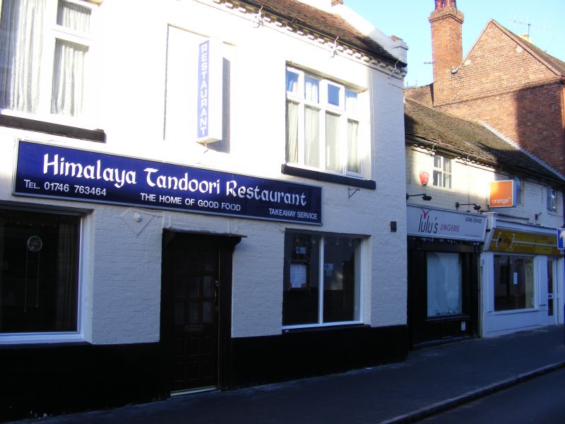
Entry Name: 11-13, High Street
Listing Date: 1 February 1974
Grade: II
Source: Historic England
Source ID: 1053999
English Heritage Legacy ID: 254424
ID on this website: 101053999
Location: High Town, Shropshire, WV16
County: Shropshire
Civil Parish: Bridgnorth
Built-Up Area: Bridgnorth
Traditional County: Shropshire
Lieutenancy Area (Ceremonial County): Shropshire
Church of England Parish: Bridgnorth
Church of England Diocese: Hereford
Tagged with: Building
1.
1954
SO 79 NW
2/87
BRIDGNORTH
HIGH STREET
(West Side)
Nos 11 to 13 (consec)
II
2.
C18. Brick; 3 storeys; 7 sash windows in cased frames (2 blocked); brick
modillion eaves; 4 hipped dormers; old tiles.
Listing NGR: SO7157993252
External links are from the relevant listing authority and, where applicable, Wikidata. Wikidata IDs may be related buildings as well as this specific building. If you want to add or update a link, you will need to do so by editing the Wikidata entry.


Other nearby listed buildings
