Approximate Location Map
Large Map »
Latitude: 52.5356 / 52°32'7"N
Longitude: -2.42 / 2°25'12"W
OS Eastings: 371607
OS Northings: 293159
OS Grid: SO716931
Mapcode National: GBR BZ.F6YF
Mapcode Global: VH90Z.0JHL
Plus Code: 9C4VGHPH+6X
Entry Name: 31, High Street
Listing Date: 1 February 1974
Grade: II
Source: Historic England
Source ID: 1053961
English Heritage Legacy ID: 254434
ID on this website: 101053961
Location: Bridgnorth, Shropshire, WV16
County: Shropshire
Civil Parish: Bridgnorth
Built-Up Area: Bridgnorth
Traditional County: Shropshire
Lieutenancy Area (Ceremonial County): Shropshire
Church of England Parish: Bridgnorth
Church of England Diocese: Hereford
Tagged with: Building
1.
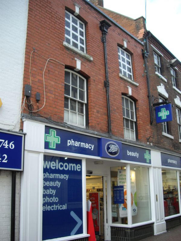
1954 BRIDGNORTH
HIGH STREET
(West Side)
No 31
SO 79 SW 2/97
II GV
2.
Undistinguished C19 facade of red brick (recently restored), the core
probably early C18. Retains rainwater head dated 1729. Modern shop fronts.
Included for group value.
Nos 23 to 37 (consec) form a group
Listing NGR: SO7159593156
External links are from the relevant listing authority and, where applicable, Wikidata. Wikidata IDs may be related buildings as well as this specific building. If you want to add or update a link, you will need to do so by editing the Wikidata entry.


Other nearby listed buildings
