Approximate Location Map
Large Map »
Latitude: 52.5353 / 52°32'7"N
Longitude: -2.4189 / 2°25'8"W
OS Eastings: 371682
OS Northings: 293129
OS Grid: SO716931
Mapcode National: GBR BZ.F77L
Mapcode Global: VH90Z.1J2T
Plus Code: 9C4VGHPJ+4C
Entry Name: The Court
Listing Date: 9 March 1970
Grade: II
Source: Historic England
Source ID: 1307364
English Heritage Legacy ID: 254445
ID on this website: 101307364
Location: Bridgnorth, Shropshire, WV16
County: Shropshire
Civil Parish: Bridgnorth
Built-Up Area: Bridgnorth
Traditional County: Shropshire
Lieutenancy Area (Ceremonial County): Shropshire
Church of England Parish: Bridgnorth
Church of England Diocese: Hereford
Tagged with: Building
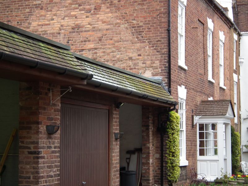
1.
1954 BRIDGNORTH
HIGH STREET
(East Side)
No 49 (The Court)
SO 79 SW 2/108 9.3.70.
II
2.
C18. Red brick; 2 storeys; 3 sash windows in broad frames with rusticated
heads. Formerly with 6-panel door and bracketed cornice hood, now replaced
by modern door and porch. Stone eaves; 2 gabled dormers; tiles. Right-hand
part with 1 sash window and modern casement below belongs to adjoining
house.
Listing NGR: SO7168293129
External links are from the relevant listing authority and, where applicable, Wikidata. Wikidata IDs may be related buildings as well as this specific building. If you want to add or update a link, you will need to do so by editing the Wikidata entry.


Other nearby listed buildings
