Approximate Location Map
Large Map »
Latitude: 52.5355 / 52°32'7"N
Longitude: -2.4193 / 2°25'9"W
OS Eastings: 371653
OS Northings: 293151
OS Grid: SO716931
Mapcode National: GBR BZ.F746
Mapcode Global: VH90Z.0JVN
Plus Code: 9C4VGHPJ+57
Entry Name: 54, High Street
Listing Date: 9 March 1970
Grade: II
Source: Historic England
Source ID: 1367489
English Heritage Legacy ID: 254450
ID on this website: 101367489
Location: Bridgnorth, Shropshire, WV16
County: Shropshire
Civil Parish: Bridgnorth
Built-Up Area: Bridgnorth
Traditional County: Shropshire
Lieutenancy Area (Ceremonial County): Shropshire
Church of England Parish: Bridgnorth
Church of England Diocese: Hereford
Tagged with: Building
1
1954 BRIDGNORTH
HIGH STREET
(East Side)
No 54
SO 79 SW 2/113 9.3.70.
II GV
2.
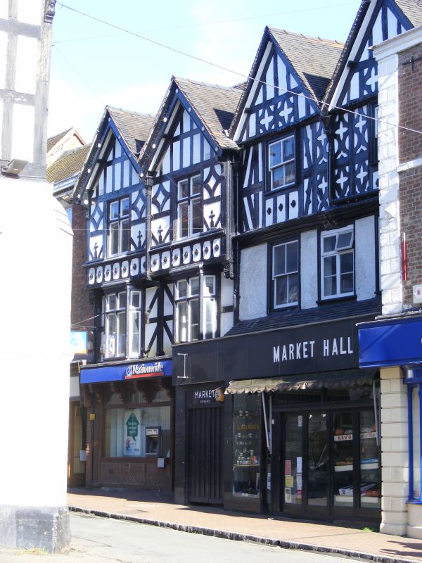
Modern front of imitation timber framing. Side elevation with exposed
timber framing painted black with whitened panels. Very picturesque with
old windows and forming a complete "black and white" courtyard with No
55 adjoining.
Nos 50 and 51. Swan Inn and Nos 53 to 57 (consec) form a group
Listing NGR: SO7165393151
External links are from the relevant listing authority and, where applicable, Wikidata. Wikidata IDs may be related buildings as well as this specific building. If you want to add or update a link, you will need to do so by editing the Wikidata entry.


Other nearby listed buildings
