Approximate Location Map
Large Map »
Latitude: 52.5364 / 52°32'11"N
Longitude: -2.4199 / 2°25'11"W
OS Eastings: 371612
OS Northings: 293256
OS Grid: SO716932
Mapcode National: GBR BZ.F6Z6
Mapcode Global: VH90Z.0HJY
Plus Code: 9C4VGHPJ+H2
Entry Name: 75, High Street
Listing Date: 1 February 1974
Grade: II
Source: Historic England
Source ID: 1307351
English Heritage Legacy ID: 254456
ID on this website: 101307351
Location: High Town, Shropshire, WV16
County: Shropshire
Civil Parish: Bridgnorth
Built-Up Area: Bridgnorth
Traditional County: Shropshire
Lieutenancy Area (Ceremonial County): Shropshire
Church of England Parish: Bridgnorth
Church of England Diocese: Hereford
Tagged with: Building
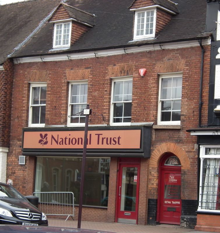
1.
1954 BRIDGNORTH
HIGH SIREET
(East Side)
No 75
SO 79 SW 2/119
II
2.
Late C18 and later. Bed brick; 2 storeys plus attic; 4 sash windows (single
glazing bars) with flat brick arches; moulded stone eaves; 2 modern or
restored gabled dormers; tiles. Arched doorway on right-hand side; modern
shop front.
Listing NGR: SO7161293256
External links are from the relevant listing authority and, where applicable, Wikidata. Wikidata IDs may be related buildings as well as this specific building. If you want to add or update a link, you will need to do so by editing the Wikidata entry.


Other nearby listed buildings
