Approximate Location Map
Large Map »
Latitude: 52.5365 / 52°32'11"N
Longitude: -2.42 / 2°25'11"W
OS Eastings: 371611
OS Northings: 293264
OS Grid: SO716932
Mapcode National: GBR BZ.F6Y2
Mapcode Global: VH90Z.0HJW
Plus Code: 9C4VGHPJ+H2
Entry Name: 77, High Street
Listing Date: 9 March 1970
Grade: II
Source: Historic England
Source ID: 1367491
English Heritage Legacy ID: 254457
ID on this website: 101367491
Location: High Town, Shropshire, WV16
County: Shropshire
Civil Parish: Bridgnorth
Built-Up Area: Bridgnorth
Traditional County: Shropshire
Lieutenancy Area (Ceremonial County): Shropshire
Church of England Parish: Bridgnorth
Church of England Diocese: Hereford
Tagged with: Building
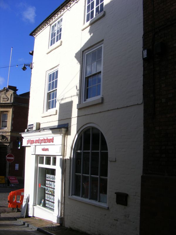
1.
1954 BRIDGNORTH
HIGH STREET
(East Side)
No 77
SO 79 SW 2/120 9.3.70.
II
2.
C18 and later refronting to C17 fabric. Painted brick; 2 storeys plus
attic; five-light wood mullioned bay window and 1 sash window; 2 gabled
dormers; brick modillion eaves; steeply pitched tiled roof. Late C19
shop front.
Listing NGR: SO7161193264
External links are from the relevant listing authority and, where applicable, Wikidata. Wikidata IDs may be related buildings as well as this specific building. If you want to add or update a link, you will need to do so by editing the Wikidata entry.


Other nearby listed buildings
