Approximate Location Map
Large Map »
Latitude: 52.5356 / 52°32'8"N
Longitude: -2.4131 / 2°24'47"W
OS Eastings: 372076
OS Northings: 293163
OS Grid: SO720931
Mapcode National: GBR BZ.F8NM
Mapcode Global: VH90Z.4J4K
Plus Code: 9C4VGHPP+6Q
Entry Name: 39, Mill Street
Listing Date: 1 February 1974
Grade: II
Source: Historic England
Source ID: 1053977
English Heritage Legacy ID: 254473
ID on this website: 101053977
Location: Low Town, Shropshire, WV15
County: Shropshire
Civil Parish: Bridgnorth
Built-Up Area: Bridgnorth
Traditional County: Shropshire
Lieutenancy Area (Ceremonial County): Shropshire
Church of England Parish: Bridgnorth
Church of England Diocese: Hereford
Tagged with: Building
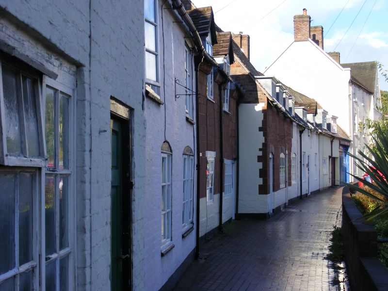
1.
1954 BRIDGNORTH
MILL STREET
(Low Town)
(West Side)
No 39
SO 79 SW 4/143
II GV
2.
C17-18, Colourwashed sandstone patched with painted brick; 1 storey and
attic; 2 early C19 wood mullioned casement windows and 2 wood mullioned
and transomed dormer windows breaking above eaves; plank door; old tiles.
No 33 and Nos 35 to 43 (consec) form a group
Listing NGR: SO7207693163
External links are from the relevant listing authority and, where applicable, Wikidata. Wikidata IDs may be related buildings as well as this specific building. If you want to add or update a link, you will need to do so by editing the Wikidata entry.


Other nearby listed buildings
