Approximate Location Map
Large Map »
Latitude: 52.5342 / 52°32'3"N
Longitude: -2.4144 / 2°24'51"W
OS Eastings: 371985
OS Northings: 293011
OS Grid: SO719930
Mapcode National: GBR BZ.FGB4
Mapcode Global: VH90Z.3KFM
Plus Code: 9C4VGHMP+M6
Entry Name: The Vine Public House
Listing Date: 18 July 1949
Grade: II
Source: Historic England
Source ID: 1053938
English Heritage Legacy ID: 254483
ID on this website: 101053938
Location: Low Town, Shropshire, WV15
County: Shropshire
Civil Parish: Bridgnorth
Built-Up Area: Bridgnorth
Traditional County: Shropshire
Lieutenancy Area (Ceremonial County): Shropshire
Church of England Parish: Bridgnorth
Church of England Diocese: Hereford
Tagged with: Pub
1.
1.
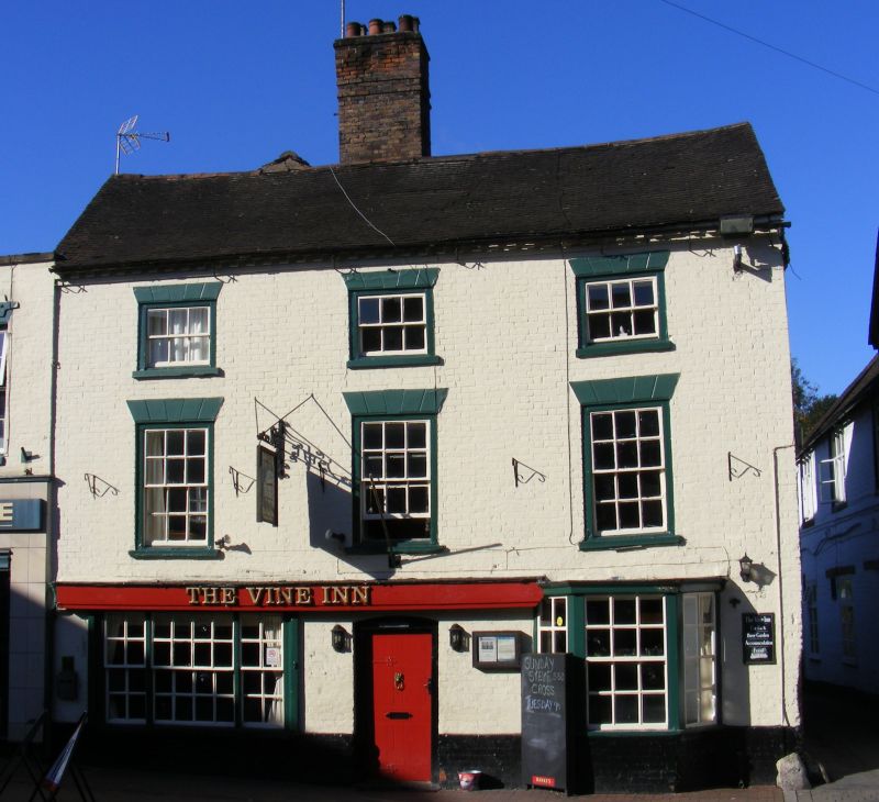
1954 BRIDGNORTH
MILL STREET
(Low Town)
(West Side)
No 57 (The Vine
public House)
SO 79 SW 2 and 4/153 18.7.49.
II GV
2.
Early C19 painted brick to earlier sandstone. 3 storeys; 3 sash windows
with engraved lintels; brick eaves; old tiles. Ground floor alterations
with original bay window and sashes on right-hand side.
Nos 51 to 57 (consec) form a group
Listing NGR: SO7198593011
External links are from the relevant listing authority and, where applicable, Wikidata. Wikidata IDs may be related buildings as well as this specific building. If you want to add or update a link, you will need to do so by editing the Wikidata entry.


Other nearby listed buildings
