Approximate Location Map
Large Map »
Latitude: 52.537 / 52°32'13"N
Longitude: -2.4206 / 2°25'13"W
OS Eastings: 371571
OS Northings: 293320
OS Grid: SO715933
Mapcode National: GBR BZ.F6SJ
Mapcode Global: VH90Z.0H6H
Plus Code: 9C4VGHPH+QQ
Entry Name: North Gate
Listing Date: 18 July 1949
Grade: II
Source: Historic England
Source ID: 1374846
English Heritage Legacy ID: 254490
ID on this website: 101374846
Location: High Town, Shropshire, WV16
County: Shropshire
Civil Parish: Bridgnorth
Built-Up Area: Bridgnorth
Traditional County: Shropshire
Lieutenancy Area (Ceremonial County): Shropshire
Church of England Parish: Bridgnorth
Church of England Diocese: Hereford
Tagged with: Building
1.
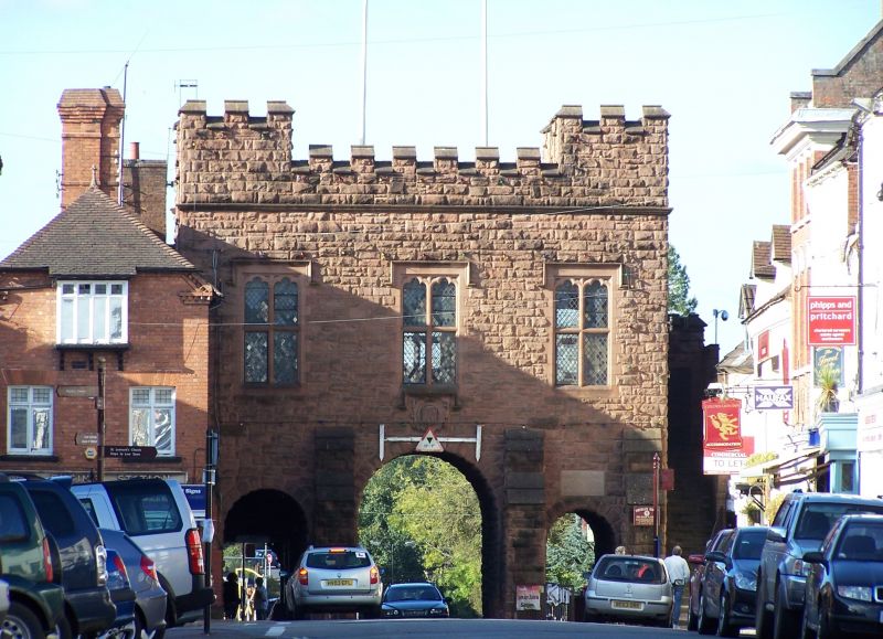
1954 BRIDGNORTH
NORTHGATE
(West Side)
North Gate
SO 79 SW 2/159 18.7.49.
II GV
2.
Circa 1910. Sandstone encasing plain brick structure of 1740. Single
storey on 3 arches across road: battlements; 3 trefoil-headed transomed
mullioned windows Adjoining building over a piazza.
Nos 21 to 25 (consec) and North Gate form a group
Listing NGR: SO7157193320
External links are from the relevant listing authority and, where applicable, Wikidata. Wikidata IDs may be related buildings as well as this specific building. If you want to add or update a link, you will need to do so by editing the Wikidata entry.


Other nearby listed buildings
