Approximate Location Map
Large Map »
Latitude: 52.5339 / 52°32'2"N
Longitude: -2.4136 / 2°24'49"W
OS Eastings: 372038
OS Northings: 292977
OS Grid: SO720929
Mapcode National: GBR BZ.FGHR
Mapcode Global: VH90Z.3KVV
Plus Code: 9C4VGHMP+HG
Entry Name: 4, St Johns Street
Listing Date: 18 July 1949
Grade: II
Source: Historic England
Source ID: 1053950
English Heritage Legacy ID: 254508
ID on this website: 101053950
Location: Low Town, Shropshire, WV15
County: Shropshire
Civil Parish: Bridgnorth
Built-Up Area: Bridgnorth
Traditional County: Shropshire
Lieutenancy Area (Ceremonial County): Shropshire
Church of England Parish: Bridgnorth
Church of England Diocese: Hereford
Tagged with: Building
1.
1954 BRIDGNORTH
ST JOHN'S STREET
(Low Town)
(South Side)
No 4
SO 79 SW 3/173 18.7.49.
II GV
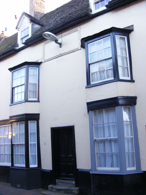
2.
C18. Stucco; 2 storeys; 2 tiered wood bay window with sashes; simple
wood doorcase; moulded stone panel above (later); plain wood eaves; old
tiles; 2 dormers.
Nos 1 to 5 (consec) form a group
Listing NGR: SO7203892977
External links are from the relevant listing authority and, where applicable, Wikidata. Wikidata IDs may be related buildings as well as this specific building. If you want to add or update a link, you will need to do so by editing the Wikidata entry.


Other nearby listed buildings
