Approximate Location Map
Large Map »
Latitude: 52.5339 / 52°32'1"N
Longitude: -2.413 / 2°24'46"W
OS Eastings: 372078
OS Northings: 292971
OS Grid: SO720929
Mapcode National: GBR BZ.FGN4
Mapcode Global: VH90Z.4K5W
Plus Code: 9C4VGHMP+HQ
Entry Name: 10A and 11, St Johns Street
Listing Date: 1 February 1974
Grade: II
Source: Historic England
Source ID: 1367482
English Heritage Legacy ID: 254513
ID on this website: 101367482
Location: Low Town, Shropshire, WV15
County: Shropshire
Civil Parish: Bridgnorth
Built-Up Area: Bridgnorth
Traditional County: Shropshire
Lieutenancy Area (Ceremonial County): Shropshire
Church of England Parish: Bridgnorth
Church of England Diocese: Hereford
Tagged with: Building
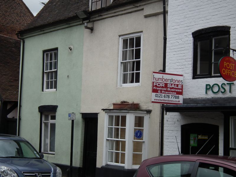
1.
1954 BRIDGNORTH
ST JOHN'S STREET
(Low Town)
(South Side)
No 10A and 11
SO 79 SW 3/178
II GV
2.
Late C18. Roughcast; 2 storeys and attic; 2 sash windows in broad frames;
simple three-light bay window and casement window to ground floor; central
square-headed covered way; old tiles. Included for group value.
Nos 7, 8, 10, 10A, 11, 15 and 16 form a group
Listing NGR: SO7207892971
External links are from the relevant listing authority and, where applicable, Wikidata. Wikidata IDs may be related buildings as well as this specific building. If you want to add or update a link, you will need to do so by editing the Wikidata entry.


Other nearby listed buildings
